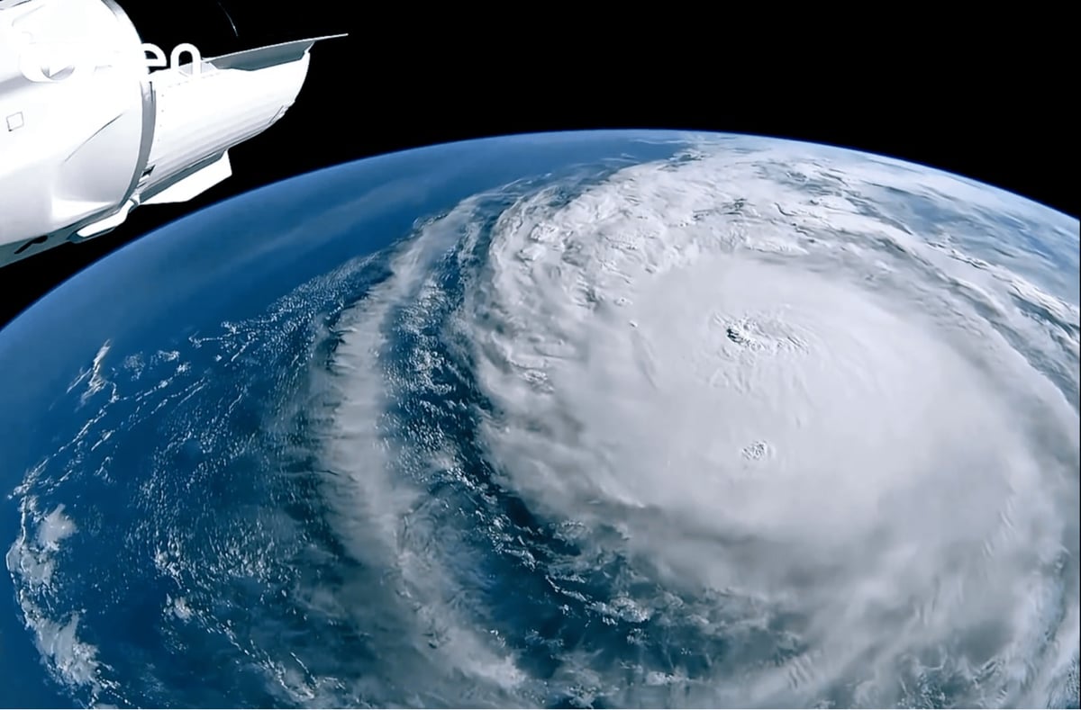
In Florida, flooding is a huge cause of death and destruction from hurricanes. This video looks at how a town called Babcock Ranch was designed to withstand hurricane flooding through some smart engineering.
Yet this one town, Babcock Ranch, has been hit by four hurricanes and basically came out unscathed. There was no flooding at all. So we asked the engineer who helped build this town to break down its hidden designs.
Related: John Seabrook’s piece in this week’s New Yorker, In an Age of Climate Change, How Do We Cope with Floods? (archive).
Vermont feels like the frontier of climate change in the Northeast. Farmers in the bottomlands, who previously planted wheat and barley, are beginning to plant rice, which can be underwater for two days without damage to the crop. The old roads that early Vermont settlers hacked out on hilltops, which lasted for more than two hundred years, are melting back into the forest. Extreme-rain events scour the roads down to bedrock ledges, rendering them impassable, and, because no one then uses them, any blown-down trees don’t get cleared. The next storm brings more blowdowns. A road that I went mountain biking on ten years ago, when it was a distinct pathway with old-growth trees on each side, lined by aged stone walls, is now such a tangle of fallen trees, branches, and rocks that it’s hard to tell a road was ever there.
Vermont is the second least populated state, after Wyoming, with fewer than six hundred and fifty thousand residents; it is also the fourth highest in disaster-relief funding per capita, nearly all of it flood-related. Washington County ranked first nationally in disaster declarations between 2011 and 2024. Annual precipitation in the state has increased six inches since the nineteen-sixties, and heavier-than-normal rain events in the Northeast are expected to increase by as much as fifty-two per cent by 2100. Vermont is a laboratory for the study of intense rainfall in steep terrain, and a proving ground for scientists, policymakers, regulators, and land-use planners who are on the front lines of a recurring catastrophe that traditional methods of prevention — dredging a river’s bottom, armoring its sides, berming its banks — have only made worse.
I live in Washington County so how communities are attempting to mitigate flooding is of great interest to me.

Zoë Schlanger writes about the potentially dangerous and incredibly powerful hurricane now bearing down on Florida’s Gulf Coast and how it’s been supercharged in several ways by climate change.
As Hurricane Milton exploded from a Category 1 storm into a Category 5 storm over the course of 12 hours yesterday, climate scientists and meteorologists were stunned. NBC6’s John Morales, a veteran TV meteorologist in South Florida, choked up on air while describing how quickly and dramatically the storm had intensified. To most people, a drop in pressure of 50 millibars means nothing; a weatherman understands, as Morales said mid-broadcast, that “this is just horrific.” Florida is still cleaning up from Helene; this storm is spinning much faster, and it’s more compact and organized.
In a way, Milton is exactly the type of storm that scientists have been warning could happen; Michael Wehner, a climate scientist at Lawrence Berkeley National Laboratory, in California, called it shocking but not surprising. “One of the things we know is that, in a warmer world, the most intense storms are more intense,” he told me. Milton might have been a significant hurricane regardless, but every aspect of the storm that could have been dialed up has been.
My thoughts are with everyone in Milton’s path and also with those still recovering & cleaning up from Helene. Please stay safe, everyone.
Using a combination of satellite data and mathematical weather models, scientists at NASA’s Goddard Space Flight Center made this simulation that shows how aerosols like dust, smoke, and salt were circulated in the atmosphere during the 2017 hurricane season. It’s amazing to see how far some of these things spread.
During the 2017 hurricane season, the storms are visible because of the sea salt that is captured by the storms. Strong winds at the surface lift the sea salt into the atmosphere and the particles are incorporated into the storm. Hurricane Irma is the first big storm that spawns off the coast of Africa. As the storm spins up, the Saharan dust is absorbed in cloud droplets and washed out of the storm as rain. This process happens with most of the storms, except for Hurricane Ophelia. Forming more northward than most storms, Ophelia traveled to the east picking up dust from the Sahara and smoke from large fires in Portugal. Retaining its tropical storm state farther northward than any system in the Atlantic, Ophelia carried the smoke and dust into Ireland and the UK.
I watched this several times to pick up on different things…the hurricanes of course, but also how smoke from the forest fires in the Pacific Northwest makes it all the way to Scotland (!!!) and dust from the Sahara desert makes it to the Caribbean (also !!!). (via phil plait)
Update: All that dust from the Sahara blowing across the ocean? Some of the dust, 27 million tons per year on average, is deposited in the Amazon basin in South America, providing the ecosystem there vital phosphorus:
This trans-continental journey of dust is important because of what is in the dust, Yu said. Specifically the dust picked up from the Bodélé Depression in Chad, an ancient lake bed where rock minerals composed of dead microorganisms are loaded with phosphorus. Phosphorus is an essential nutrient for plant proteins and growth, which the Amazon rain forest depends on in order to flourish.
(via tom whitwell)
Absolutely scrumtrilescent photos of hurricanes from space. The Big Picture once again. I feel as though Alan is reaching directly into my brain and asking, “hey, what photos do you want to see next to flood you with high levels of dopamine?”
Here’s MSNBC’s nifty new hurricane tracker tracking Gustav bearing down on Louisiana like a shotgun full of wind and rain. Built by Stamen. (via jimray)
With 5 weeks to go in hurricane season, tropical storm Alpha breaks the record for most named storms in the Atlantic Ocean. All of this year’s names have been used up, which means the remaining storms will be named after sequential Greek letters.
Suroweicki on gas prices and Katrina: “Americans are happy with the free market when it allows them to buy cheap T-shirts and twenty-nine-dollar DVD players, but they tend to like it less when they have to pay fifty dollars to fill up their gas tanks.”
Elizabeth Kolbert (who wrote three articles for the NYer on global warming earlier in the year) discusses global warming as a possible cause for Hurricane Katrina. Like the climate scientists on RealClimate contend, Kolbert notes that no particular storm can be caused by global warming, but that the long-term patterns don’t look good…increased greenhouse gases = warmer oceans = more destructive hurricanes. Paul Recer downplays the connection as well and cautions environmental groups who want to make political hay with scientific evidence that doesn’t support their claims.
Hurricane Ivan generated what is thought to be the tallest wave ever observed. The wave was 91 feet high.


Socials & More