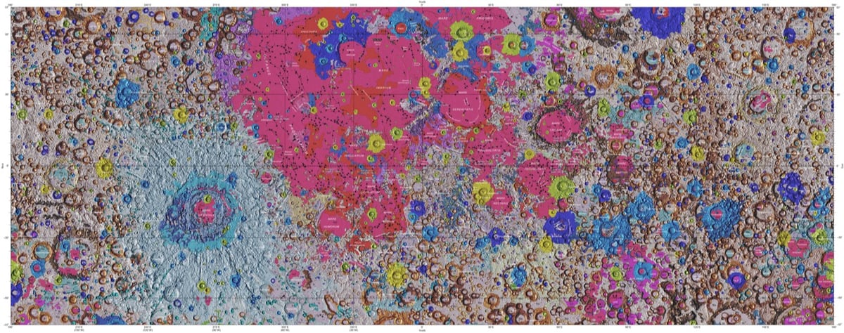
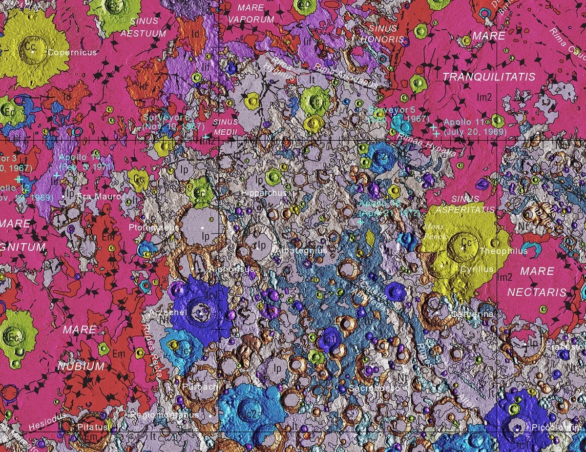
In collaboration with NASA and the Lunar and Planetary Institute, the USGS has released the first complete geological map of the Moon’s surface.
This new work represents a seamless, globally consistent, 1:5,000,000-scale geologic map derived from the six digitally renovated geologic maps (see Source Online Linkage below). The goal of this project was to create a digital resource for science research and analysis, future geologic mapping efforts, be it local-, regional-, or global-scale products, and as a resource for the educators and the public interested in lunar geology.
Strange Maps has more information on how the map came to be and what it shows.
The map was created by the U.S. Geological Service’s Astrogeology Science Center in Flagstaff, Arizona. In collaboration with NASA and the Lunar and Planetary Institute, it combined six ‘regional’ maps of the Moon made during the Apollo era (1961-1975) with input from more recent unmanned lunar missions.
This included data on the polar regions from NASA’s Lunar Orbiter Laser Altimeter (LOLA) and close-ups of the equatorial zone from the Japanese Space Agency’s recent SELENE mission.
The two images above show the entire map and a detailed view of a single area (which includes the landing sites of 3 Apollo missions) while the video shows a rotating globe version of the map.
Last week, I stood in the middle of the caldera of a supervolcano, walked on rocks billions of years old, and traveled back in time simply by driving down a mountain. I looked a bison in the eye at five yards. I witnessed the final resting place of a 12 million-year-old fossilized horse buried in volcanic ash. I saw a rainbow emerging from a mighty thundercloud — powerful with a little bit of tender. I talked civilly with red hatters in red states and found some common ground at least. I drove across the western United States, from Iowa to Oregon, over the course of 10 days. Here is some of what I saw and learned.
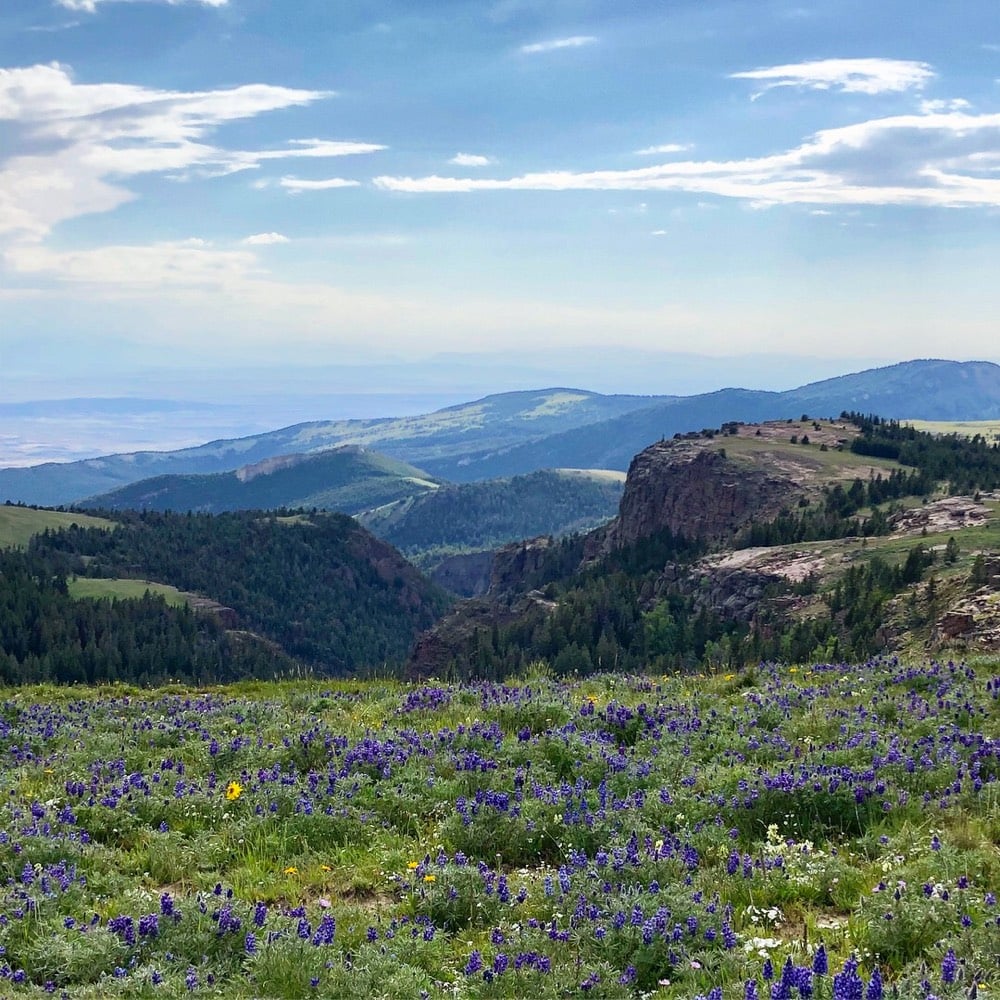
Biggest surprise of the trip, part 1: The Bighorn Mountains and The Bighorn National Forest. I had planned to just drive though, up and over, on my way to Yellowstone, but I ended up stopping here for quite a while. The Bighorns aren’t as spectacular as Yellowstone or some of the other parks, but it’s a hell of a lot less crowded. I’d go back and spend a few days here easy.
Surprisingly, despite spending 57 hours in the car, I was not bored a single minute of my trip. I marveled at the landscape, played music, and thought. I thought a lot. I expected to listen to a bunch of audiobooks but only managed to finish one I was most of the way through and the first third of another…the landscape was just too distracting most of the time. My experience leads me to believe I might be a good candidate for a solo Mars mission (aside from the one-way thing).
Animals seen on my trip, a partial list: rabbits, prairie dogs, antelope, ducks, geese, pelicans, pheasants, a moose, a wolf, elk, bison, deer, and a bunch of birds I couldn’t identify. The prairie dogs sat near their holes peeping at each other…it was really cute. The moose was a juvenile male in Yellowstone who looked lost & confused; he trotted alongside the road for a bit, then swam across the river and took off into the woods. I was apprehensive about not seeing a bison on my trip, but I shouldn’t have worried…Yellowstone was lousy with ‘em. Pro tip: bring a good pair of binoculars, possibly left over from eclipse-watching.
Yellowstone was one of the highlights (with a caveat that I’ll get to in a second). A single park containing all these different landscapes, from volcanic wastelands to mountain peaks to verdant river valleys to evergreen forests to grasslands…it’s a geographic marvel. But here’s the but: it’s also really crowded in the summer. At times, it felt like a nature mall, with herds of consumers moving from the bison shop to the geyser store. Reminded me a bit of my experience at the Louvre, itself a wonderful place too crowded to enjoy.
Final roadtrip stats: 2748 miles driven in 10 days and a total of 57 hours in the car. 718 photos and videos taken. I visited seven states — Iowa, Nebraska, South Dakota, Wyoming, Montana, Idaho, and Oregon — and spent at least one night in each save Idaho. Lowest point: 810’. Highest point: 11,070’.
Somewhere west of the Missouri River, which separates Iowa & Missouri from Nebraska & Kansas, the dominance in the eastern US of human activity & organization gives way to geology and geography. Even in the sparser areas of the Midwest, you look down from an airplane and see the Jefferson grid: square parcels of land, each with a group of buildings contained somewhere within it. Further west, hills and mountains and volcanoes and rivers and streams and forests and plains dominate the landscape and how people move within it. The West is not yet tamed, not by a long shot, and acknowledging this goes a long way toward understanding the people who live here.
Biggest surprise of the trip, part 2: High altitude wildflower meadows. When I stopped my car at a scenic overlook at 9400’ in the Bighorn Mountains and saw a path down a gentle slope through a meadow of wildflowers growing very close to the ground, I didn’t think a whole lot about it. Pretty scene, right? I grabbed my daypack from the car and as soon as I stepped down onto the path and into the meadow, this amazing smell sent me reeling. For 20 minutes, I walked in an olfactory daze to the crest of the next hill and back. OMG, what an amazing sensation…a definite high-water mark.
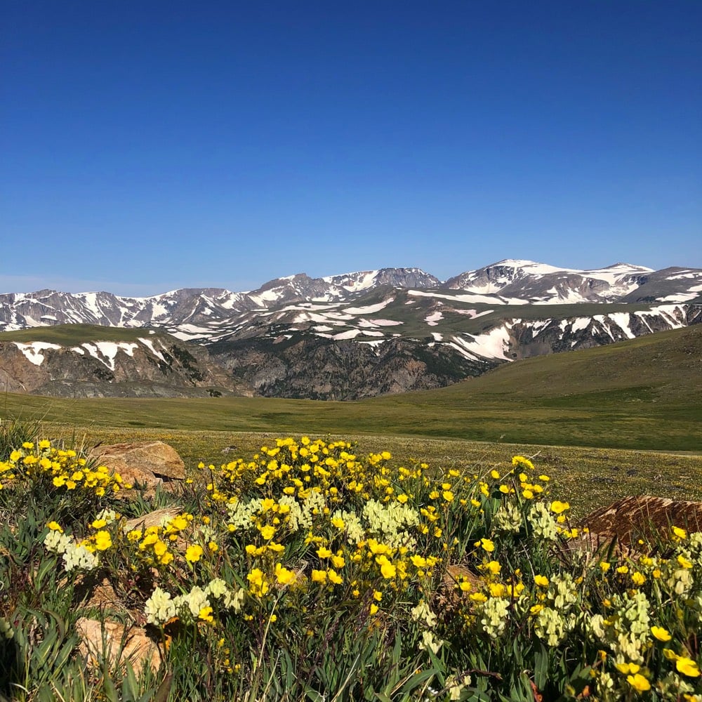
The speed limit on the freeways in South Dakota, Wyoming, Montana, and Idaho was 80 mph. On some rural undivided two-lane highways, the limit was still 70 mph, which I found astounding. But the lanes and the shoulders were way wider than in Vermont, the roads flatter and straighter, and traffic was few and far between most of the time. Still, even just that little extra speed really cuts down on drivers’ potential reaction times.
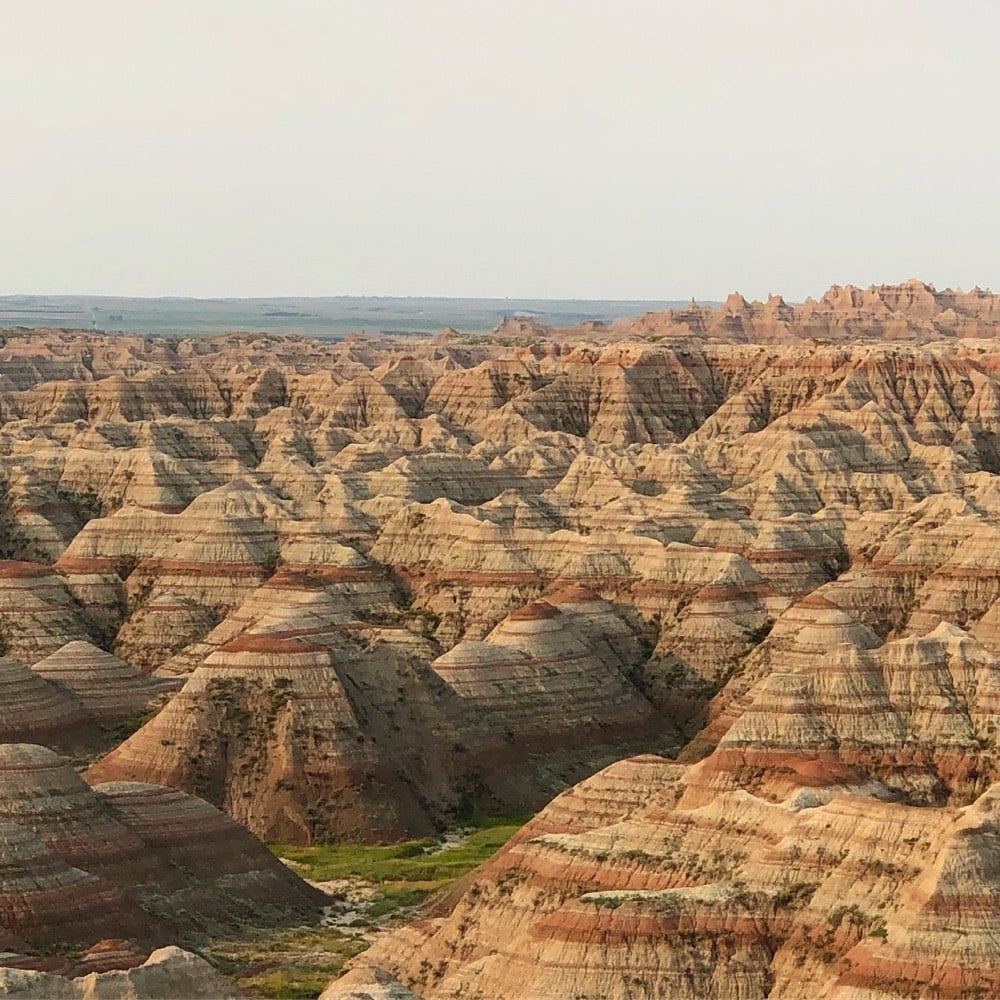
I had high hopes for the Badlands, and it lived up to the hype. Magnificent desolation, accessible, and not super crowded. I could (and probably should) have spent a couple of days there easy.
Food was not a highlight or a focus of this trip, mostly because I didn’t spend a tremendous amount of time seeking out good places to eat. I had some Thai lettuce wraps w/ bison in SD that were pretty good, some just-fine sushi in Missoula, and a delicious tostada scramble in Rhododendron, OR. Maybe the best thing I ate was a homemade breakfast burrito I bought at a gas station in Red Lodge, Montana. It was a struggle to find non-meat things to eat — I’m not a vegetarian, but man cannot subsist on burgers & hot dogs & steaks & BBQ for a week and a half w/o GI discomfort. With some notable exceptions, food in the US is more homogenous than ever…you can get anything almost anywhere.
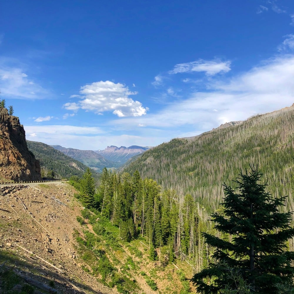
Biggest surprise of the trip, part 3: The hosts at the B&B I stayed at in Wyoming advised me to enter Yellowstone via the Beartooth Highway and I am so glad I took their advice. The 68-mile drive was called “the most beautiful drive in America” by former CBS correspondant Charles Kuralt and he might be right. At the top of the pass, you drive just short of 11,000’ above sea level; I climbed above the 11K mark for a stunning 360° view of the entire area. Reader, I may have done the arms-wide-on-the-bow-of-the-Titanic gesture on top of a rock at the top of the world…no apologies.
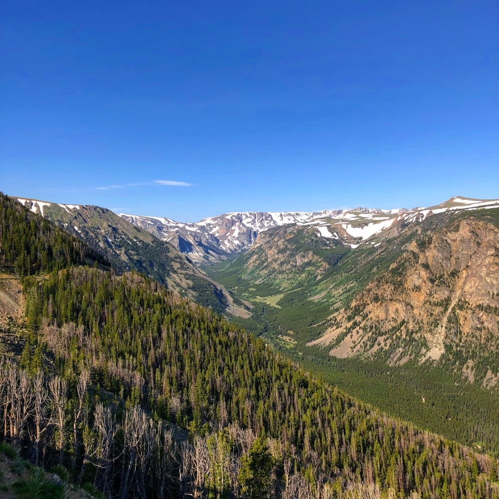
About 5 minutes after I checked into my B&B near Cody, WY, I looked out my window to see a rain cloud off in the distance with a rainbow coming out of it. Chuckling, I asked my host if that was a common occurence around here. “Pretty much,” he replied, “especially with climate change.” A life-long resident of the area, he went on to explain that it rains a lot more there now than “20-30 years ago”. “See all that grass out there? It’s supposed to be brown this time of year.”
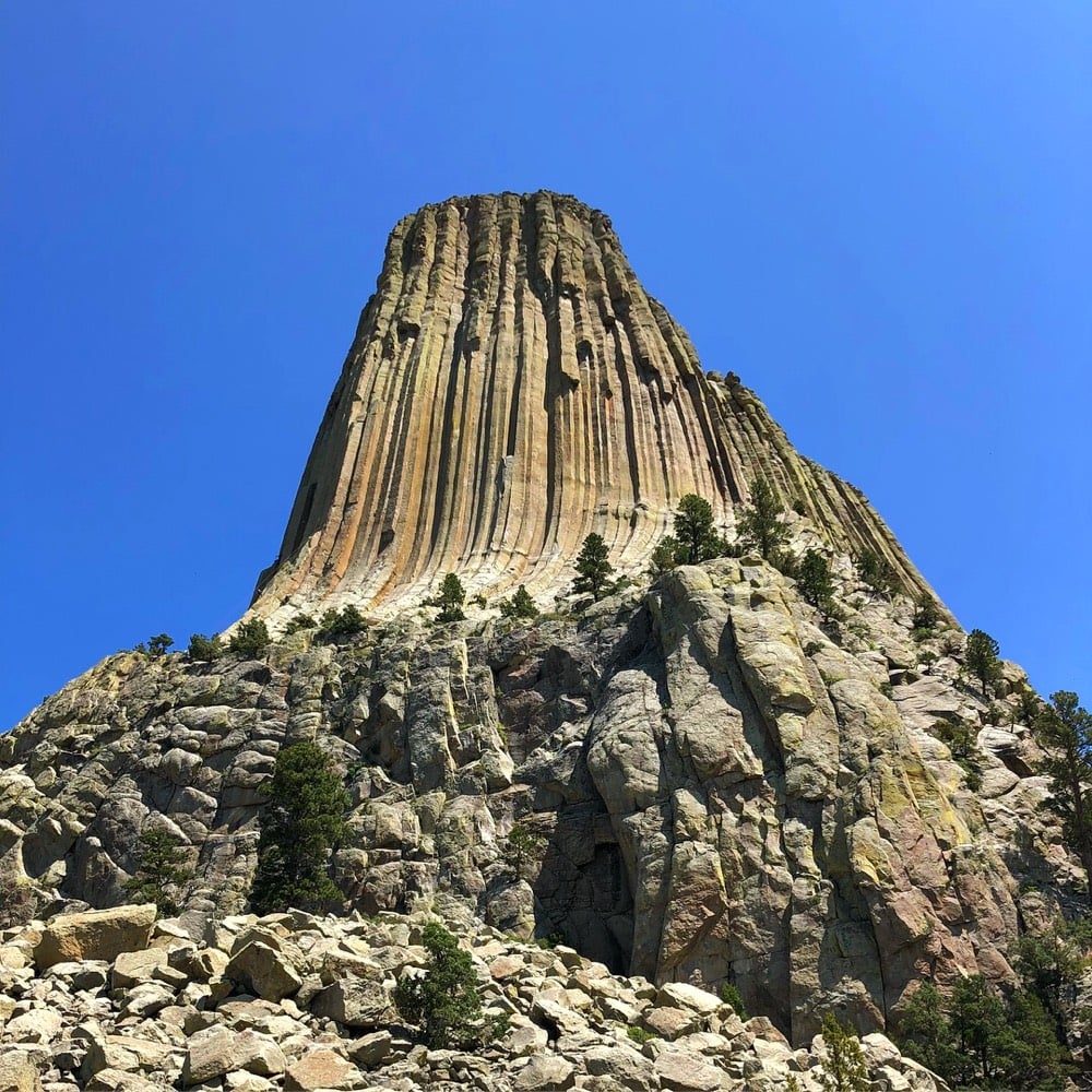
Several people told me before my trip that Devils Tower was worth the effort, but as I spotted it off in the distance on my approach, I had my doubts. But as it got closer, I realized they’d all been right. Totally crazy geological thing worth seeing in the flesh.
At a gas station in southern South Dakota, a man noticed the Texas plates on my rental car and asked, “What’s the price of gas in Texas these days?” I explained my situation, and he said, “I’m from Texas originally and I can tell by your accent that you ain’t. What’re ya doing in this godforsaken country?”
In Wyoming, I stayed less than a mile from the Heart Mountain Relocation Center, a WWII Japanese American confinement site. From 1942 to 1945, this concentration camp held almost 14,000 people, making it the third-largest town in Wyoming at the time. The majority were American citizens and had done nothing wrong and committed no crimes…they were put there for being of Japanese heritage. I regret that my plans didn’t allow for a visit; if I’d had known beforehand that it was going to be so close, I would have made the time, given our present administration’s treatment of its Muslim citizens and asylum seekers from Central and South America. As Faulkner said, “The past is never dead. It’s not even past.”
I saw some cool thunderstorms:
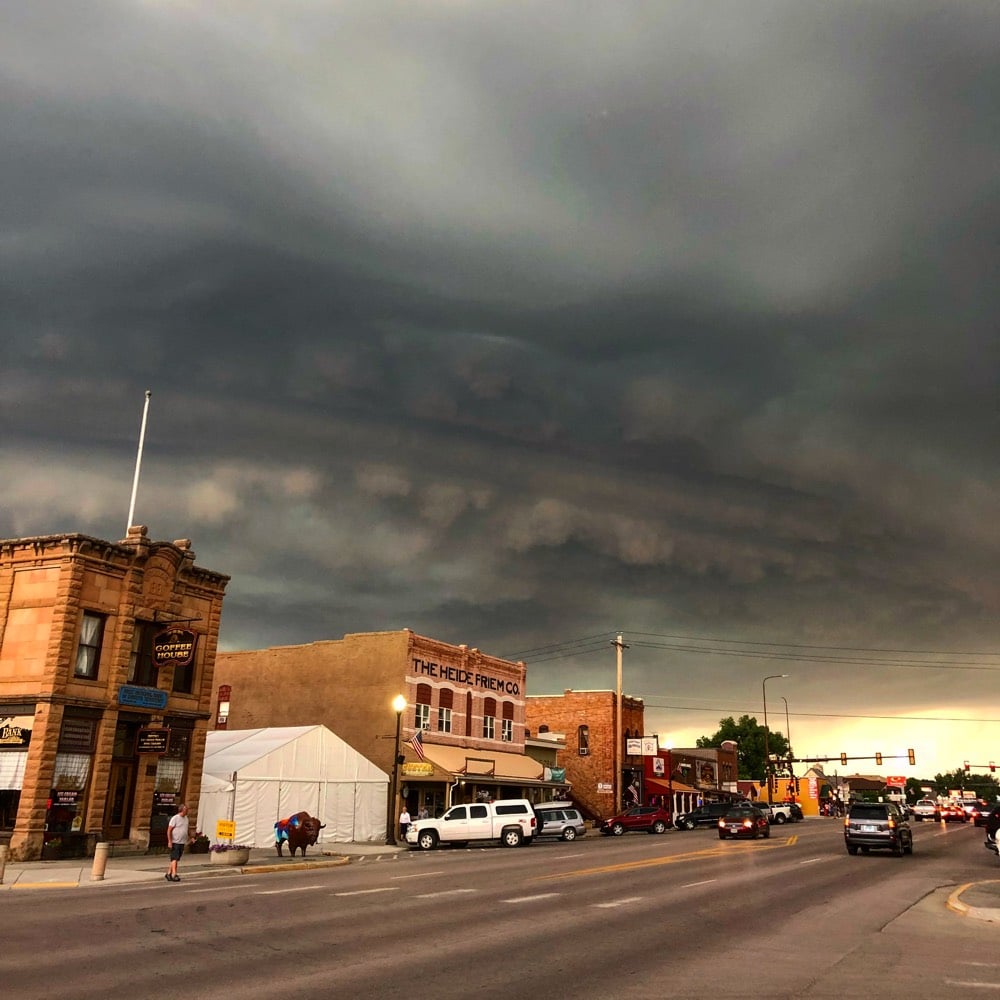
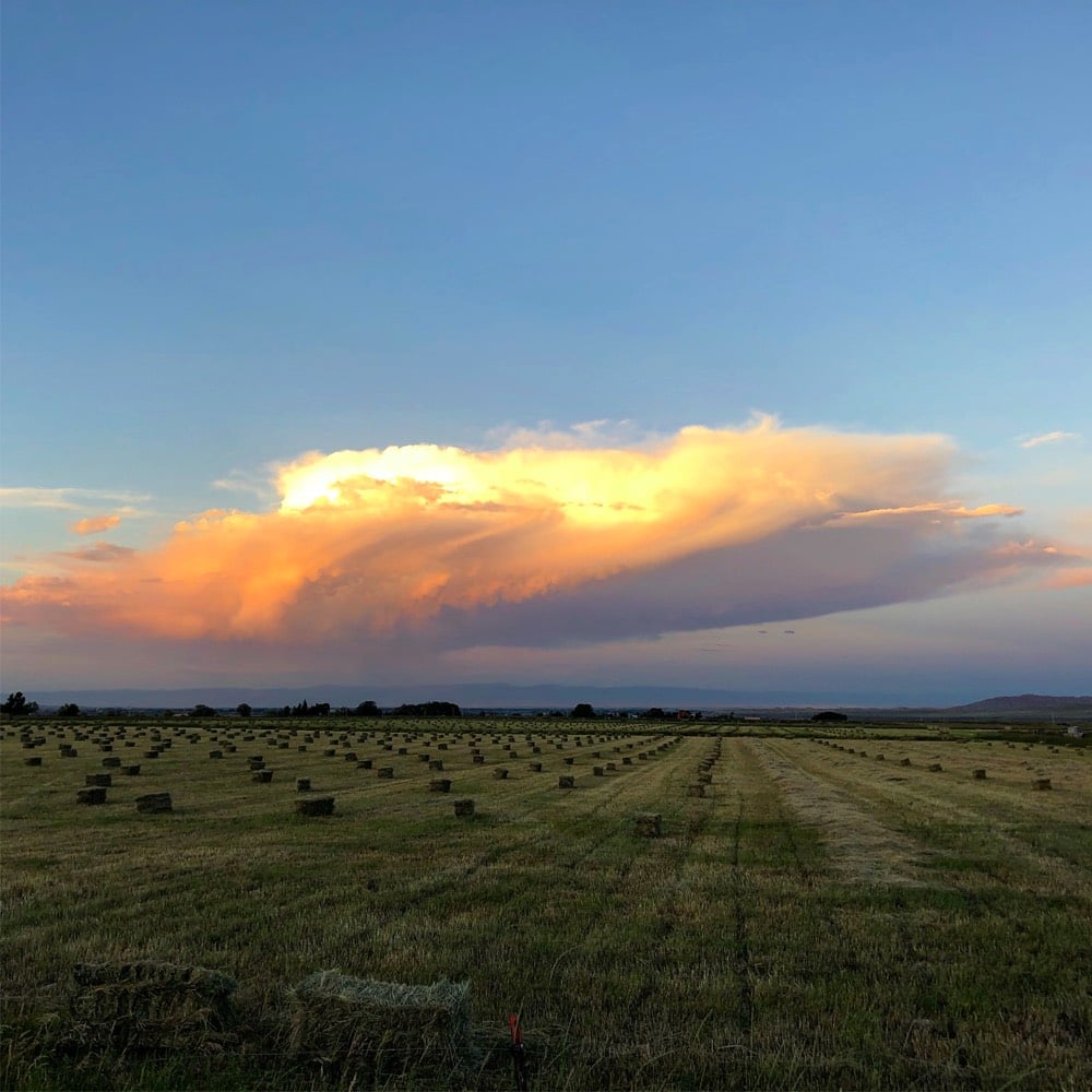
If I had a time machine, I would tell myself from two weeks ago to skip Mt Rushmore, Wind Cave, and the volcanic stuff in Yellowstone. And perhaps Wall Drug. I also would have opted to fly out of Salt Lake City instead of Portland, OR to give me more time to explore Montana and Wyoming…the trip ended up having too much driving and not enough being out in nature.
You can see more photos from my trip on Instagram and in this saved Instagram Story. I feel very lucky to have had the time and resources to take this trip. It definitely took me out of my comfort zone in both good ways and bad — the journey definitely wasn’t all sunshine and lollipops, despite what my photos might indicate. To many of us, it seems like a perilous time in our nation’s history, with many debts, old and new, coming due in rapid-fire succession. Doing this roadtrip reminded me of many great things about this country & the people who live in it and gave me the time & space to ponder how I fit into the puzzle, without the din of the news and social media. If you can manage it, I encourage you all to do the same, even if it’s just visiting someplace close that you’ve never been to: get out there and see the world and visit with its people. This world is all we have, and the more we see of it, the better we can make it.
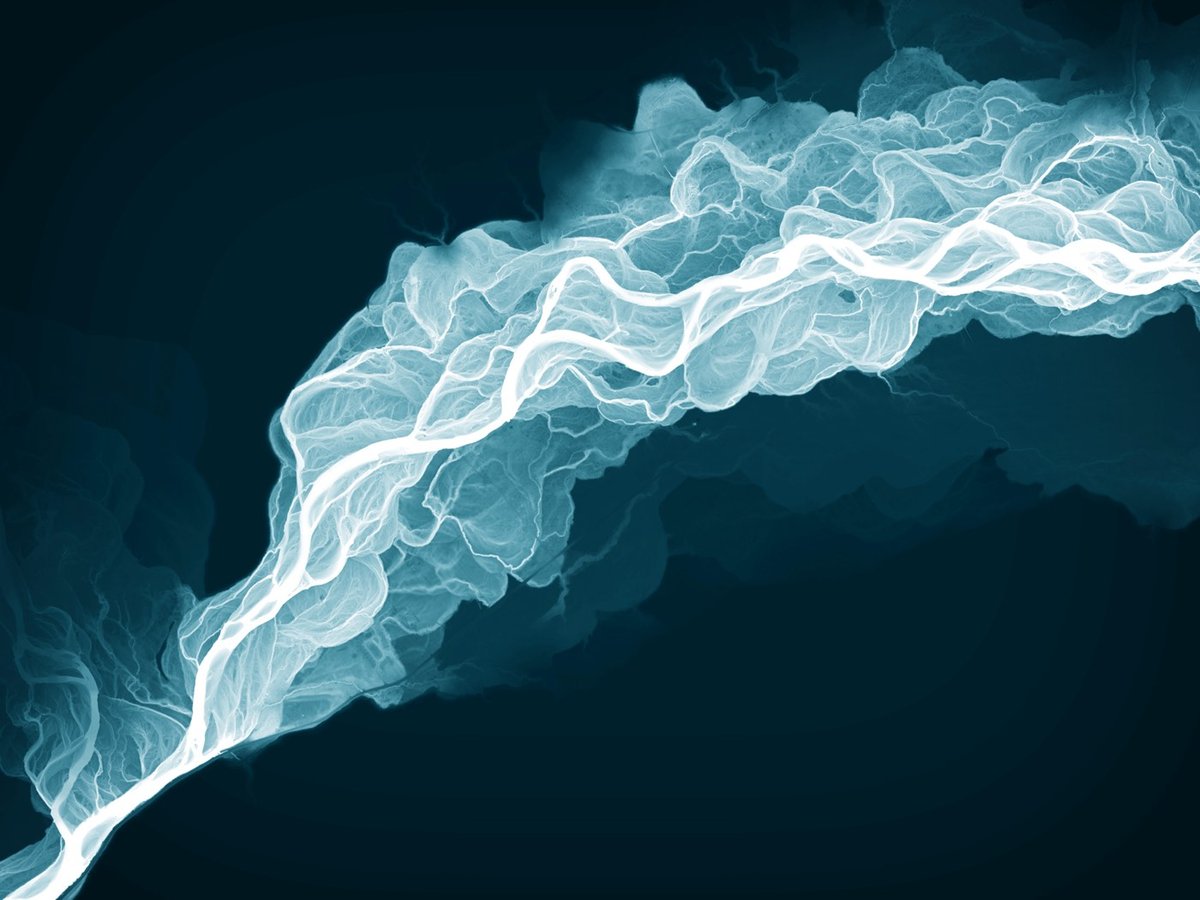
The Washington State Geological Survey is using LIDAR technology to study the geology of the land hidden under forested areas of the state. LIDAR is like radar, but instead of bouncing radio waves off of objects to detect their distances, you use lasers. When you shoot laser light at a forested area, most of it is reflected back by the trees. But some of it reaches the ground, so by measuring the light that’s reflected back from the lowest point, you get a very accurate map of the bare earth, sans nature. Using the LIDAR maps, they can study the course changes in rivers, landslides, volcanic lava flows, earthquake faults & fault zones, tsunami inundation zones, and glaciers.
The beautiful photo at the top is a LIDAR image of the Sauk River and all its current and former channels…the bluish tint makes it look like an x-ray, which it pretty much is. It also reminds me of the meander maps of the Mississippi River made by Harold Fisk for the US Army Corps of Engineers.
Here are two images of Bainbridge Island:
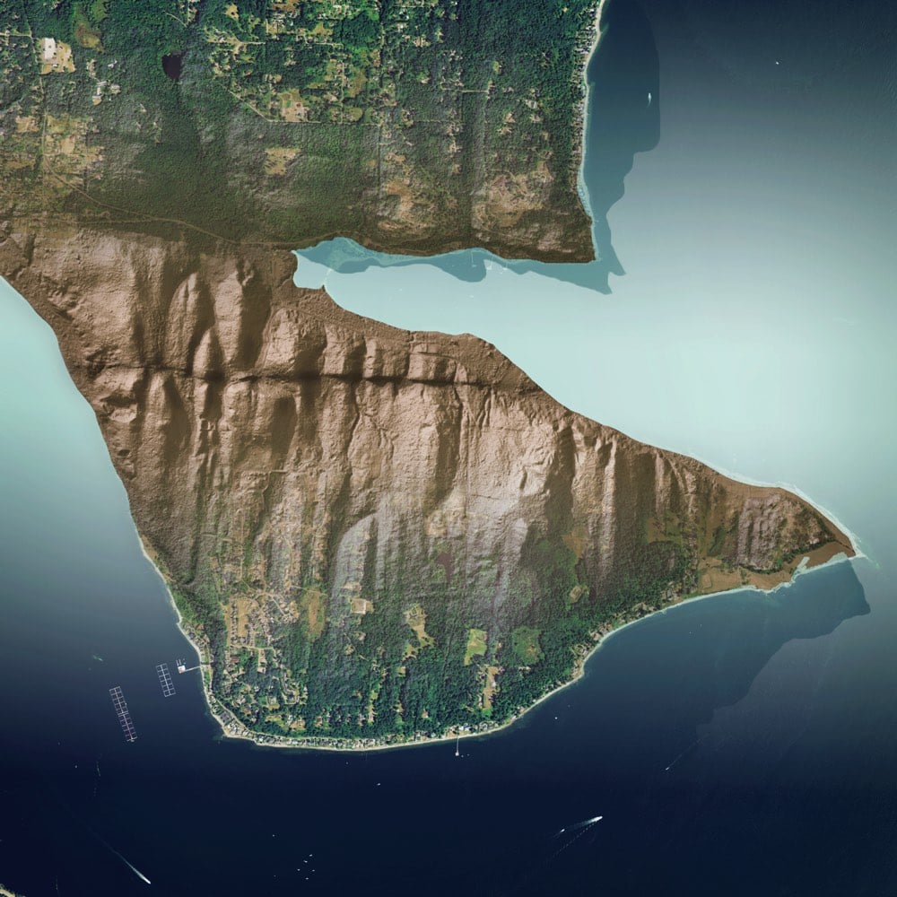
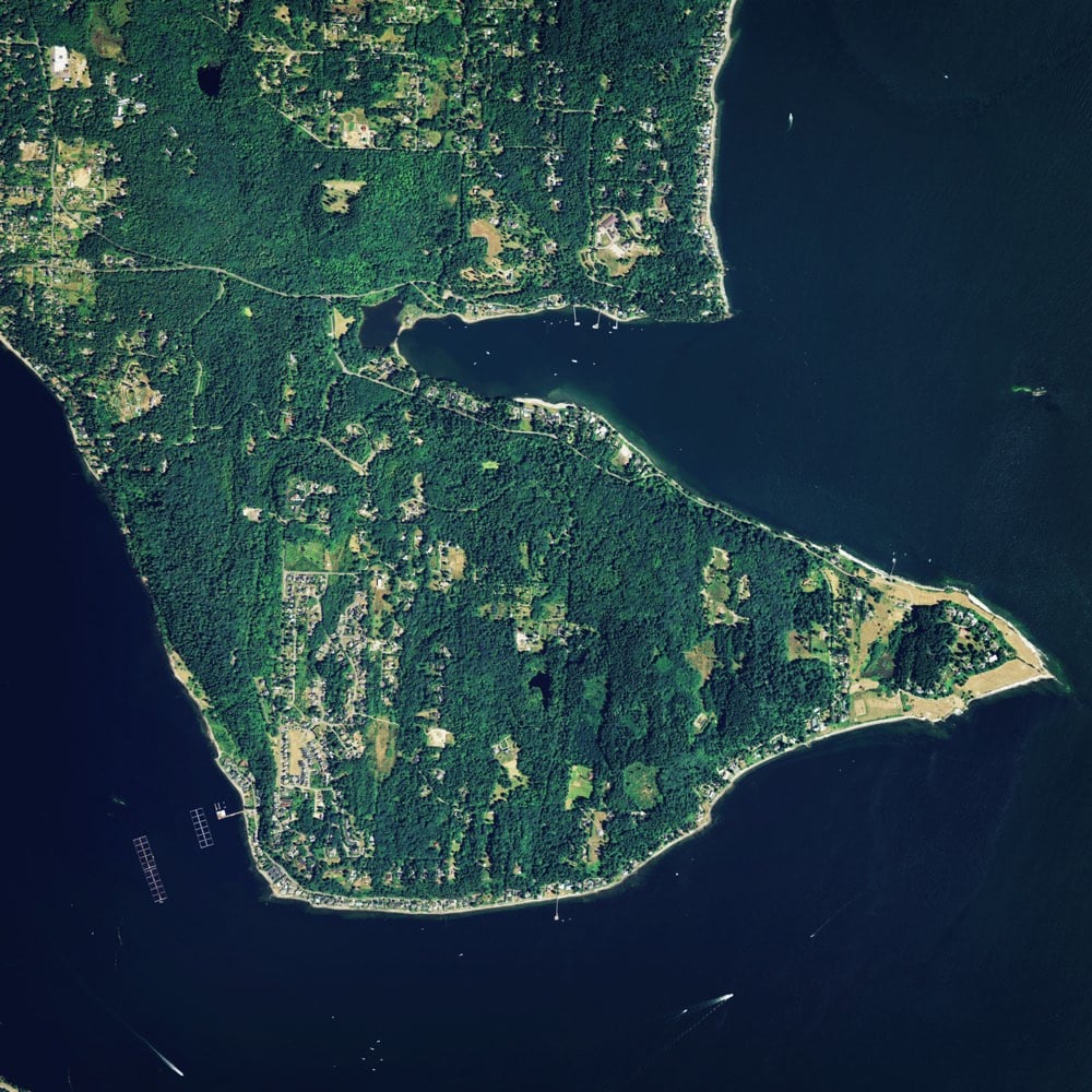
The LIDAR image clearly shows a horizontal earthquake fault scarp that’s completely hidden by the ground cover.
These two images are of drumlins left behind by a glacier:
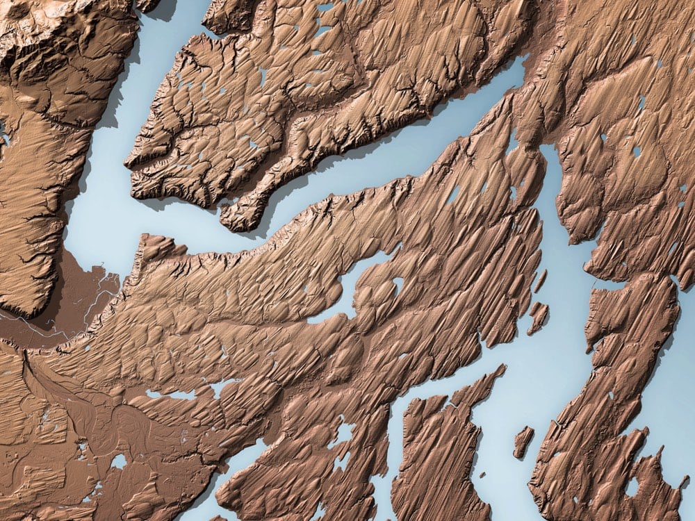
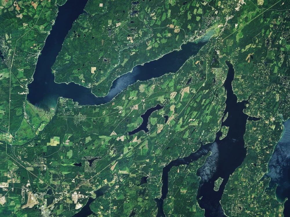
Again, the LIDAR image shows the movement of a long-gone glacier with stunning clarity compared to the satellite photo with ground cover.
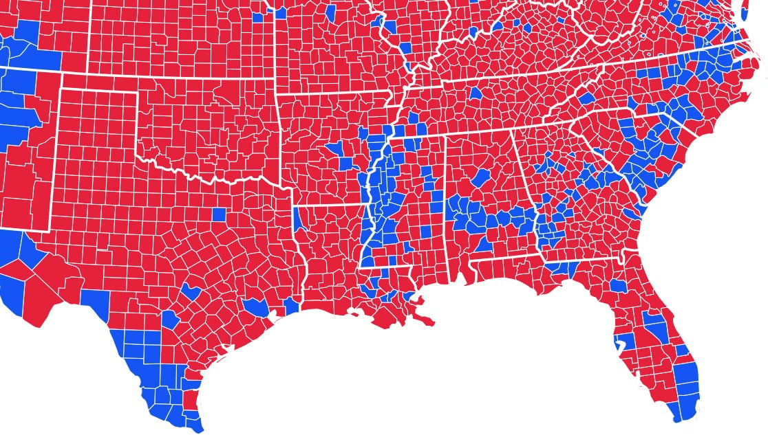
That’s a portion of the 2012 US Presidential election map of the southern states broken down by county: blue ones went Barack Obama’s way and counties in red voted for Mitt Romney.
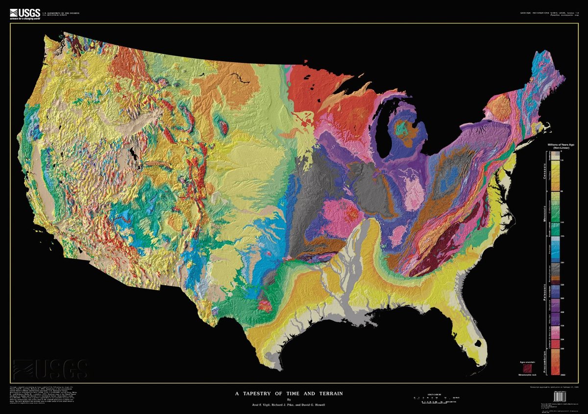
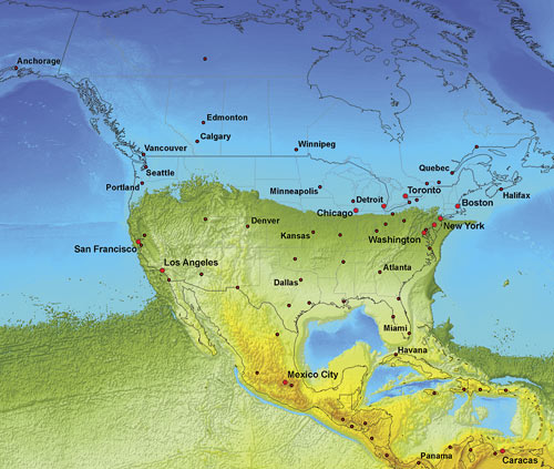
But let’s go back to the Cretaceous Period, which lasted from 145 million years ago to 65 million years ago. Back then, the coastline of what is now North America looked like this:
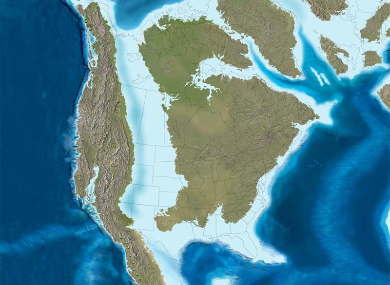
Along that ancient coastline of a shallow sea, plankton with carbonate skeletons lived and died in massive numbers, accumulating into large chalk formations on the bottom of the sea. When the sea level dropped and the sea drained through the porous chalk, rich bands of soil were left right along the former coastline. When that area was settled and farmed in the 19th century, that rich soil was perfect for growing cotton. And cotton production was particularly profitable, so enslaved people were heavily used in those areas.
McClain, quoting from Booker T. Washington’s autobiography, Up From Slavery, points out: “The part of the country possessing this thick, dark and naturally rich soil was, of course, the part of the South where the slaves were most profitable, and consequently they were taken there in the largest numbers.” After the Civil War, a lot of former slaves stayed on this land, and while many migrated North, their families are still there.
The counties in which slave populations were highest before the Civil War are still home to large African American populations, which tend to vote for Democratic presidential candidates, even as the whiter counties around them vote for Republicans. The voting pattern of those counties on the map follows the Cretaceous coastline of 100 million years ago — the plankton fell, the cotton grew, the enslaved people bled into that rich soil, and their descendants later helped a black man reach the White House.




Socials & More