A Subway-Style Map of Roman Roads Circa 125 A.D.
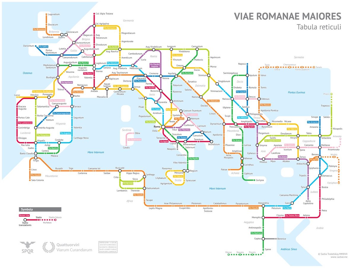
After much research, Sasha Trubetskoy has completed a subway-style map of the road system of the Roman Empire. From about 300 BC, the Romans built or improved over 250,000 miles of roads (50,000 miles were stone paved) that extended into the farthest reaches of the Empire: from Spain to modern-day Iraq to Britain to northern Africa.
Creating this required far more research than I had expected — there is not a single consistent source that was particularly good for this. Huge shoutout to: Stanford’s ORBIS model, The Pelagios Project, and the Antonine Itinerary (found a full PDF online but lost the url).
The lines are a combination of actual, named roads (like the Via Appia or Via Militaris) as well as roads that do not have a known historic name (in which case I creatively invented some names). Skip to the “Creative liberties taken” section for specifics.
(via @zachklein)
Socials & More