An Atlas for the End of the World
The Atlas for the End of the World is a project started by Penn architect Richard Weller to highlight the effects of human civilization and urbanization on our planet’s biodiversity.
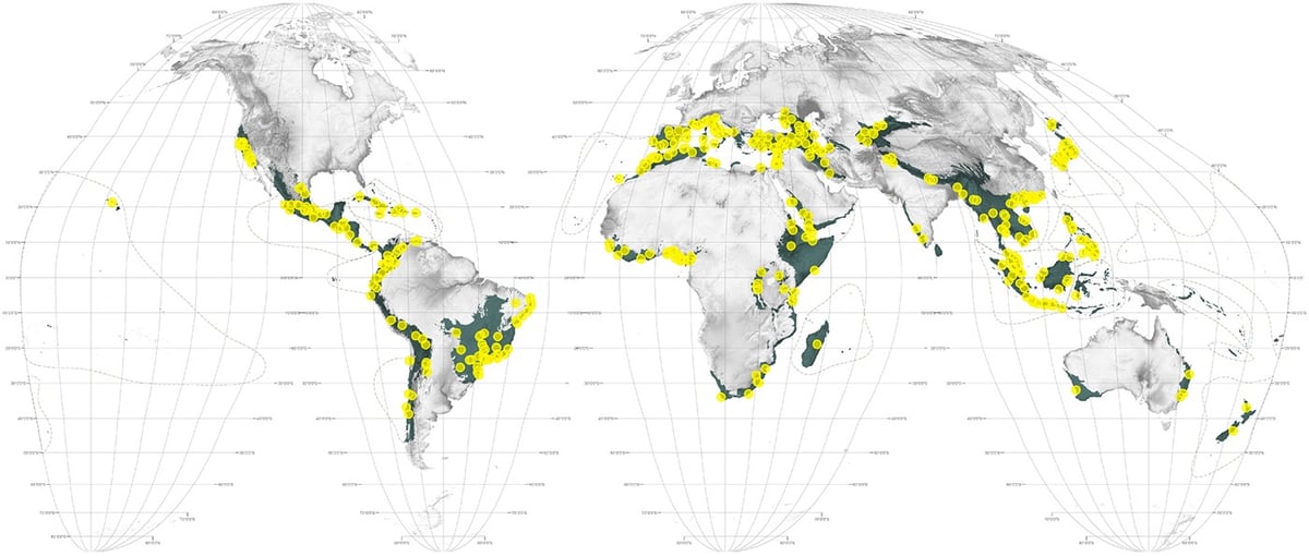
Coming almost 450 years after the world’s first Atlas, this Atlas for the End of the World audits the status of land use and urbanization in the most critically endangered bioregions on Earth. It does so, firstly, by measuring the quantity of protected area across the world’s 36 biodiversity hotspots in comparison to United Nation’s 2020 targets; and secondly, by identifying where future urban growth in these territories is on a collision course with endangered species.
There’s lots to see at the site: world and regional maps, data visualizations, key statistical data, photos of plants and animals that have been modified by humans, as well as several essays on a variety of topics.
And here’s a fun map: countries with national biodiversity strategies and action plans in place. Take a wild guess which country is one of the very few without such a plan in place!
Stay Connected