Comic book cartography
Comic Book Cartography is a now-dormant blog devoted to maps, charts, diagrams, and other visual explainers of (mostly) fictional worlds found (mostly) in old comic books.
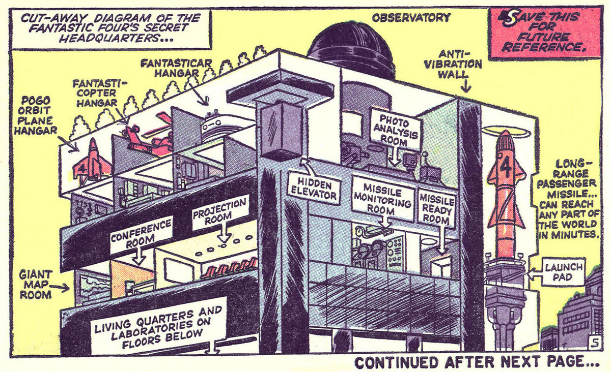
These maps are beautiful, but they’re also packed with definitive detail. I love the stern “SAVE THIS FOR FUTURE REFERENCE” on the first-ever cutaway of the Fantastic Four’s Baxter Building, from issue #3. Two issues ago, you’ve got the FF someplace called “Central City,” and The Thing looking like a poop with arms and a mouth, but already, there’s a fixed architecture for midtown Manhattan offices packed with reference ideas for future storylines. A man, a plan, Jack Kirby.
In these flattened worlds for tiny obsessives, you’ve got your narrative and your database all in one: not just maps, but routes, connections, circuits, ideas, topologies. Really, it’s dataviz, only since comics don’t have, you know, large data sets for running regressions, it’s a lot of tiny illustrations with copious labeling. Still, the future of the modern impulse to an “all in one chart” aesthetic probably starts here as much as anywhere. (Via @justinNXT.)
Update: There’s an active “Comic Cartography” Tumblr that includes more contemporary examples. Also, John Hilgart, the proprietor of Comic Book Cartography, runs an active blog on images from classic comic books called 4CP (for four-color process, naturally). (Thanks, Hampton)
Socials & More