Over at Beautiful Public Data, Jon Keegan shares some details about two huge collections of aerial photos of glaciers.
As scientists study the effects of global warming, one of the most visible and alarming indicators is the rapid shrinking of glaciers. Government scientists have been documenting the size, shape, and movement of glaciers since the 1950s employing techniques ranging from direct field observations to aerial photography.
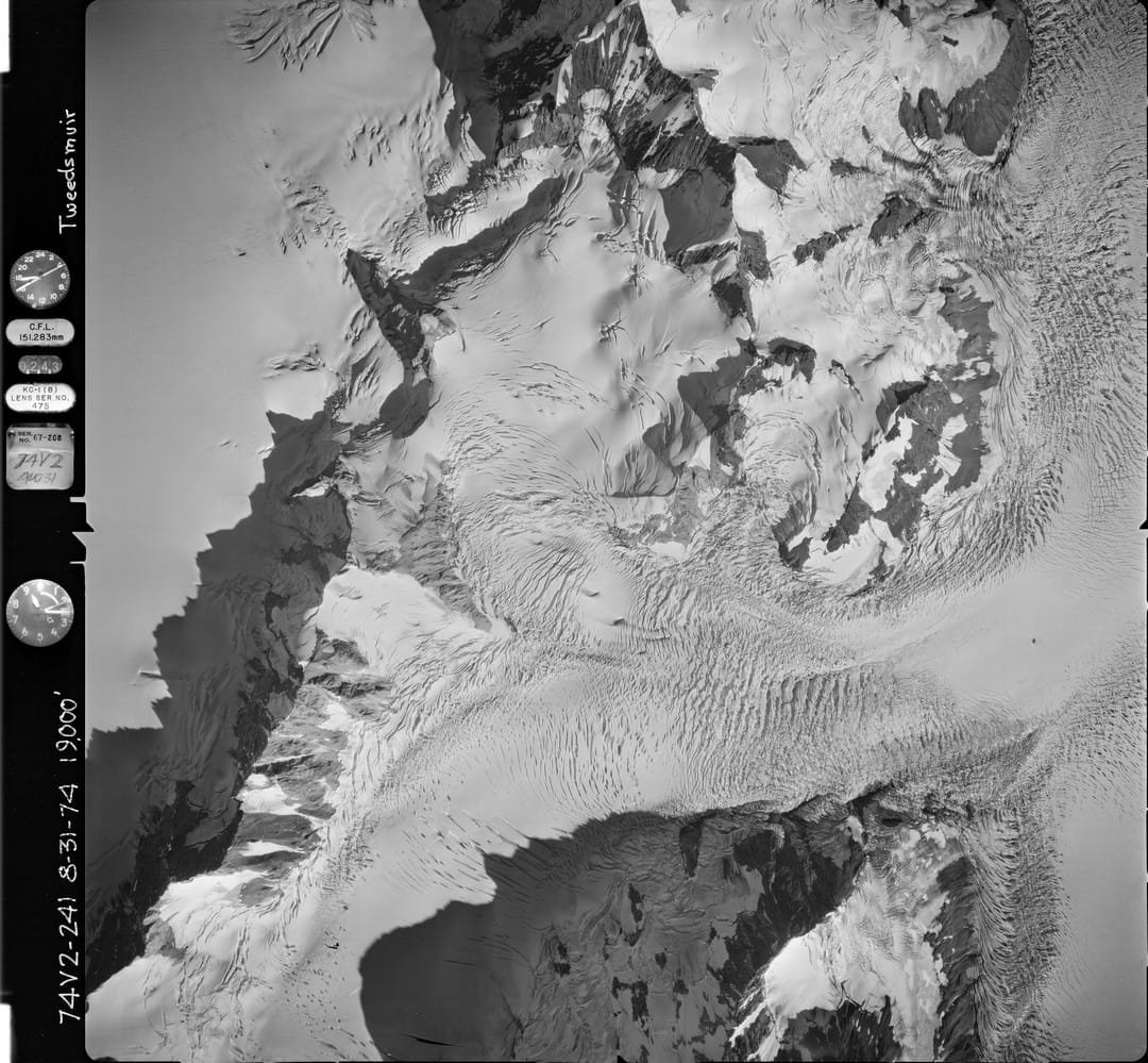
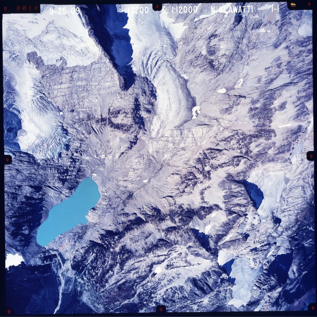
The United States Geological Survey (USGS) has one of the largest collections of aerial glacier photographs. Over 40 years, the USGS’ North American Glacier Aerial Photography (NAGAP) project captured thousands of striking high-resolution photos of glaciers and their surroundings.
From 1960 to 1983, self-taught glaciologist Austin Post used a 63-pound World War II-era Fairchild K-17 aerial reconnaissance camera to shoot over 100,000 glacier photos in the western US and Alaska. One of the bush pilots Post teamed up with was William R. Fairchild, who flew a Beech 18 twin engine airplane equipped with five K-17 cameras-one mounted on the nose, two in the belly of the plane, and one on each side.
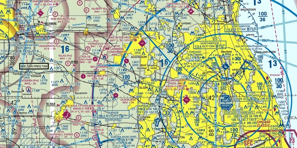
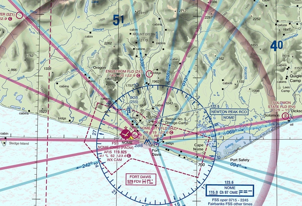
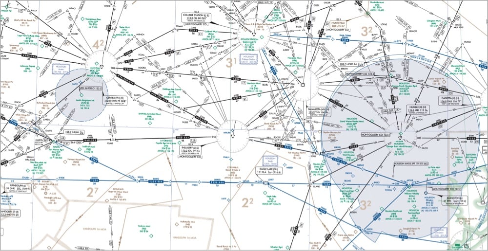
On Beautiful Public Data, Jon Keegan highlights the extremely information-rich flight maps produced by the Federal Aviation Administration that pilots use to find their way around the skies.
Among all of the visual information published by the U.S. government, there may be no product with a higher information density than the Federal Aviation Administration’s (FAA) aviation maps. Intended for pilots, the FAA publishes free detailed maps of the entire U.S. airspace, and detailed maps of airports and their surroundings and updates them frequently. The density of the critical information layered on these maps is staggering, and it is a miracle that pilots can easily decipher these maps’ at a glance.
Oh wow, this takes me back. My dad was a pilot when I was a kid and he had a bunch of FAA maps in the house, in his planes, and even on the walls of his office. I remember finding these maps both oddly beautiful and almost completely inscrutable. What a treat to be able to finally figure out how to read them, at least a little bit. And the waypoint names are fun too:
Orlando, FL has many Disney themed waypoints such as JAFAR, PIGLT, JAZMN, TTIGR, MINEE, HKUNA and MTATA. Flying into Orlando, your plane might use the SNFLD arrival path, taking you past NOOMN, FORYU, SNFLD, JRRYY and GTOUT.
Based on the waypoints near Atlanta’s Hartsfield-Jackson International, this airport must be home to some of the nerdiest air traffic controllers. There’s a crazy number of Lord of the Rings waypoints: HOBTT, SHYRE, FRDDO, BLLBO, BGGNS, NZGUL, RAETH, ORRKK, GOLLM, ROHUN, GONDR, GIMLY, STRDR, SMAWG and GNDLF.

Have you noticed there are a lot of different license plates you can choose for your car these days? So did Jon Keegan; he scraped the DMV websites of all 50 states and DC and came up with over 8,200 different plate combinations you might see out on the road.
By my count, there are currently 8,291 different vehicle license plates offered by the 50 states and the District of Columbia. States now offer a vast menu of personalized plate options for a dizzying array of organizations, professions, sports teams, causes and other groups.
My count was conducted over June and July 2023, so this should be considered a snapshot, as I’m sure some plates have changed already.
Fun fact: finishers of the Iditarod Trail Sled Dog Race are eligible to get a special “Iditarod Finisher” plate for their car.
Less fun fact, per Keegan:
Yes, license plates are still made by cheap prison labor in most states. 80% of all license plates issued in the U.S. today were made by state prisoners, with only 12 states opting out of the practice. According to a 2022 ACLU report on prison labor in the U.S., many states offer no pay at all to prisoners, while the average hourly wage across the country was between 13 and 52 cents per hour.
Here in Vermont, the use of prison labor for manufacturing things like license plates resulted in the image of a pig hidden in a cow’s spots appearing on an official crest emblazoned on state police cars back in 2012.
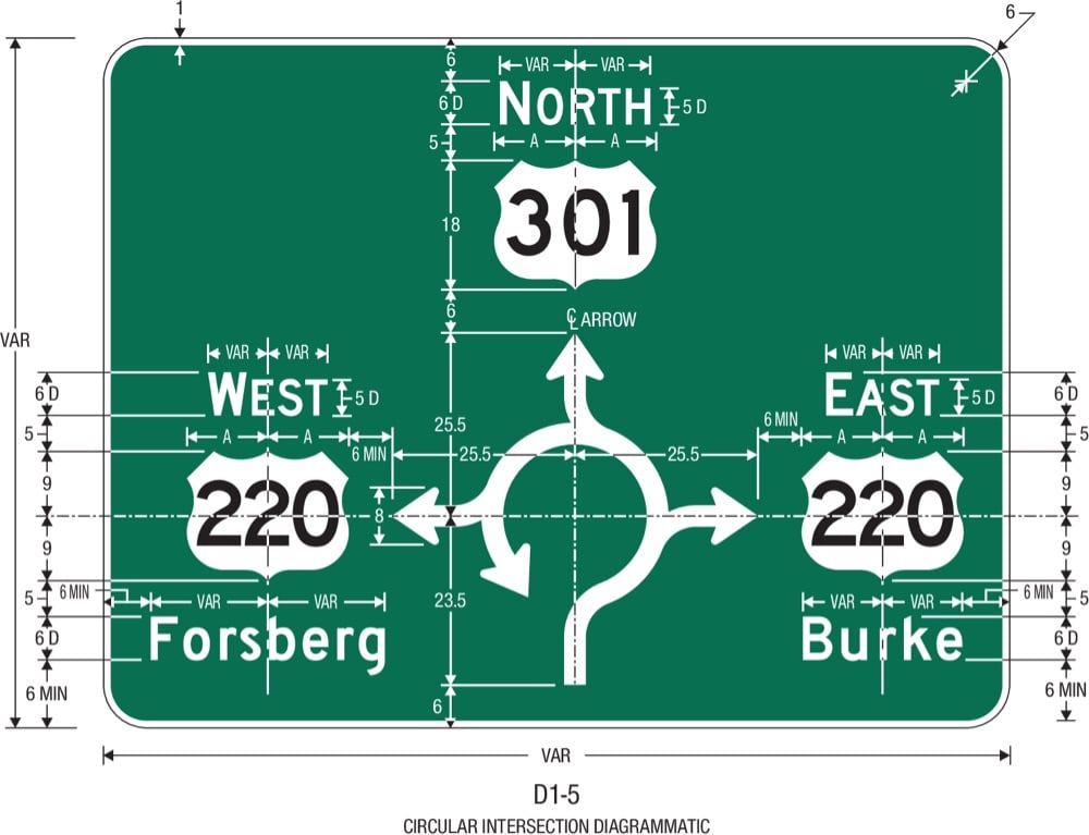
For Beautiful Public Data, Jon Keegan takes a look at the Manual on Uniform Traffic Control Devices for Streets and Highways, the style guide published by the Federal Highway Administration that governs how America’s roads are marked.
The MUTCD states that it “shall be recognized as the national standard for all traffic control devices installed on any street, highway, bikeway, or private road open to public travel”. Exact specifications for the font, size, spacing of letters, background colors, reflectivity, mounting location and orientation help ensure that traffic signs are consistently readable at a glance while driving anywhere in the U.S..
The word “uniform” is key here, as you can only imagine the chaos if each state had its own version of stop signs, and safety warnings. But states do have some freedom in the signs that they use.
Socials & More