FAA Aviation Maps


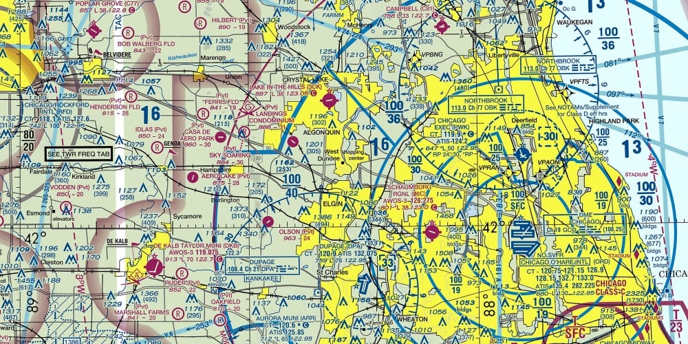
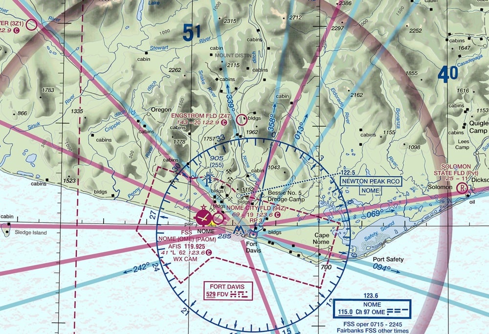
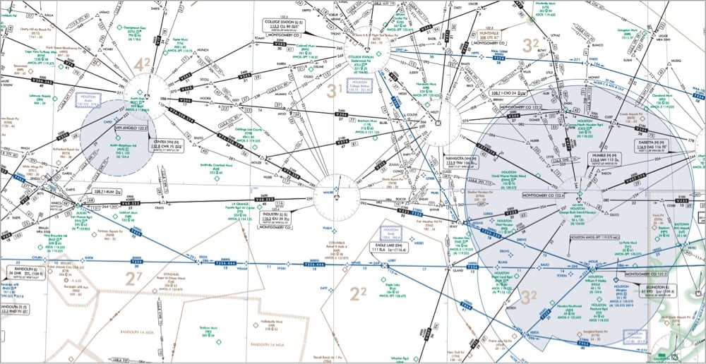
On Beautiful Public Data, Jon Keegan highlights the extremely information-rich flight maps produced by the Federal Aviation Administration that pilots use to find their way around the skies.
Among all of the visual information published by the U.S. government, there may be no product with a higher information density than the Federal Aviation Administration’s (FAA) aviation maps. Intended for pilots, the FAA publishes free detailed maps of the entire U.S. airspace, and detailed maps of airports and their surroundings and updates them frequently. The density of the critical information layered on these maps is staggering, and it is a miracle that pilots can easily decipher these maps’ at a glance.
Oh wow, this takes me back. My dad was a pilot when I was a kid and he had a bunch of FAA maps in the house, in his planes, and even on the walls of his office. I remember finding these maps both oddly beautiful and almost completely inscrutable. What a treat to be able to finally figure out how to read them, at least a little bit. And the waypoint names are fun too:
Orlando, FL has many Disney themed waypoints such as JAFAR, PIGLT, JAZMN, TTIGR, MINEE, HKUNA and MTATA. Flying into Orlando, your plane might use the SNFLD arrival path, taking you past NOOMN, FORYU, SNFLD, JRRYY and GTOUT.
Based on the waypoints near Atlanta’s Hartsfield-Jackson International, this airport must be home to some of the nerdiest air traffic controllers. There’s a crazy number of Lord of the Rings waypoints: HOBTT, SHYRE, FRDDO, BLLBO, BGGNS, NZGUL, RAETH, ORRKK, GOLLM, ROHUN, GONDR, GIMLY, STRDR, SMAWG and GNDLF.


Comments 4
Freaking love these maps. Could stare at them all day. After all these years, I never knew your dad was a pilot. Might have missed it but just one more reason that makes you who you are and someone I connect with.
Believe me, I'm not about promoting brands on your site, but since you posted these maps and your dad was a pilot, you might love 08Left.com. Modern art vibes with aviation.
Also please post some of those old maps and manuals (I assume) your dad had. That stuff is so cool.
Top two are for visual flying (which is why they include topography and visual landmarks, etc), bottom one is for instrument flying (so has mostly navaids).
You should check out the online VFR maps (can zoom in for more detail) here: http://vfrmap.com/
I recently passed the FAA test to get my Part 107 certificate to fly drones commercially (I'm a professional photographer). A primary function of the maps are safety best practices, as is most of the training I received as a drone pilot. Everything on those maps is about the relationship between the pilot and what to look out for, go to, and avoid - and best practices on how to do all of it all at once. So much information! It's clear, also, how important it is to be able to comprehend them quickly, at least during flying itself. And to study up in advance of flying. The FAA has done a sterling job in getting across this information across multiple platforms, paper, web, and mobile, and in their partnerships with various app builders, such as Aloft, to fulfill their mission.
Hello! In order to comment or fave, you need to be a current kottke.org member. If you'd like to sign up for a membership to support the site and join the conversation, you can explore your options here.
Existing members can sign in here. If you're a former member, you can renew your membership.
Note: If you are a member and tried to log in, it didn't work, and now you're stuck in a neverending login loop of death, try disabling any ad blockers or extensions that you have installed on your browser...sometimes they can interfere with the Memberful links. Still having trouble? Email me!
In order to comment or fave, you need to be a current kottke.org member. Check out your options for renewal.
This is the name that'll be displayed next to comments you make on kottke.org; your email will not be displayed publicly. I'd encourage you to use your real name (or at least your first name and last initial) but you can also pick something that you go by when you participate in communities online. Choose something durable and reasonably unique (not "Me" or "anon"). Please don't change this often. No impersonation.
Note: I'm letting folks change their display names because the membership service that kottke.org uses collects full names and I thought some people might not want their names displayed publicly here. If it gets abused, I might disable this feature.
If you feel like this comment goes against the grain of the community guidelines or is otherwise inappropriate, please let me know and I will take a look at it.
Hello! In order to leave a comment, you need to be a current kottke.org member. If you'd like to sign up for a membership to support the site and join the conversation, you can explore your options here.
Existing members can sign in here. If you're a former member, you can renew your membership.
Note: If you are a member and tried to log in, it didn't work, and now you're stuck in a neverending login loop of death, try disabling any ad blockers or extensions that you have installed on your browser...sometimes they can interfere with the Memberful links. Still having trouble? Email me!