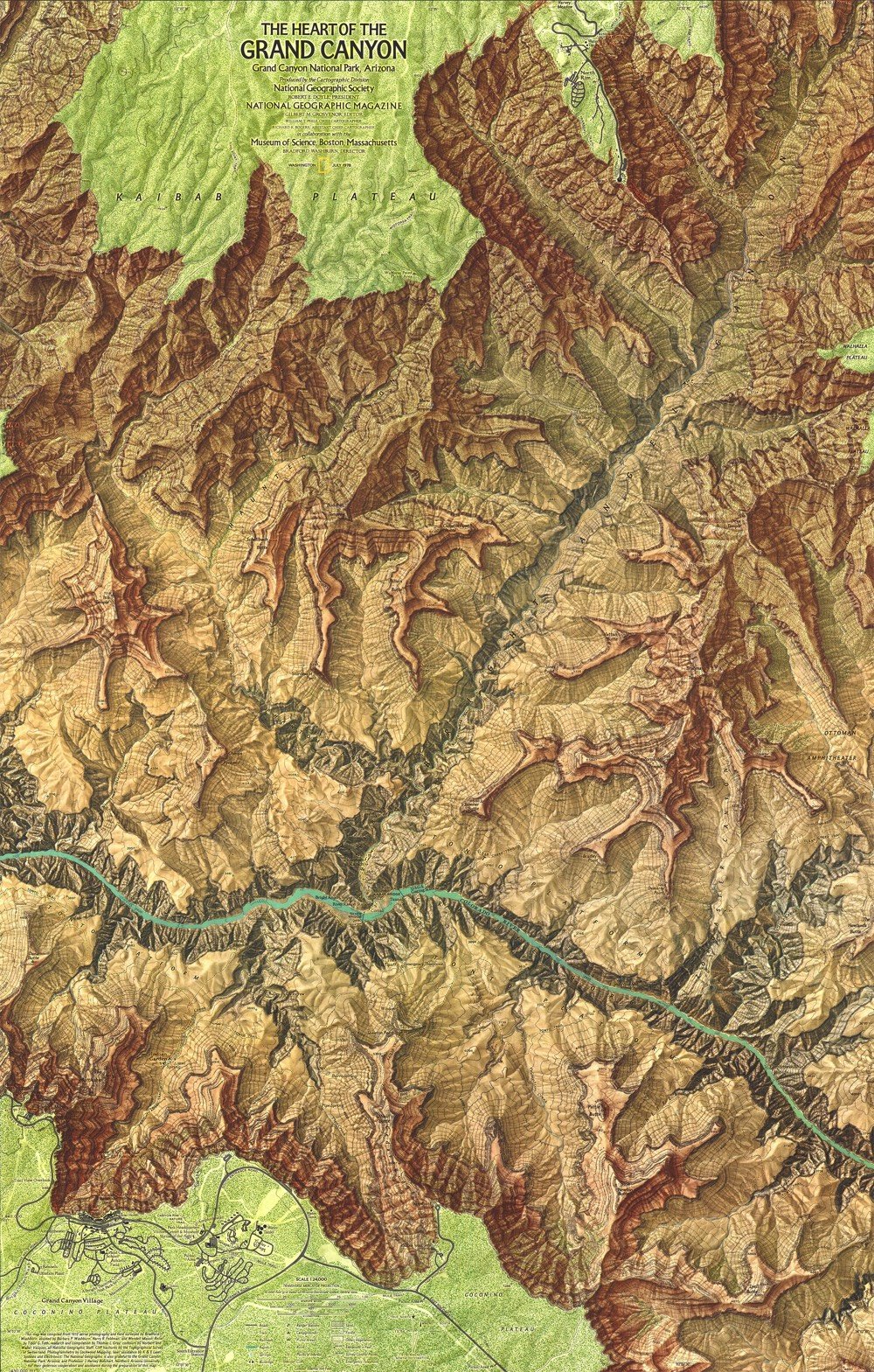
The Heart of the Grand Canyon Map
Over a period of 8 years, explorer and photographer Bradford Washburn worked with a small team and National Geographic to produce a map called The Heart of the Grand Canyon. Published in 1978, it is “still considered by many to be the most beautiful map of the area ever created”.
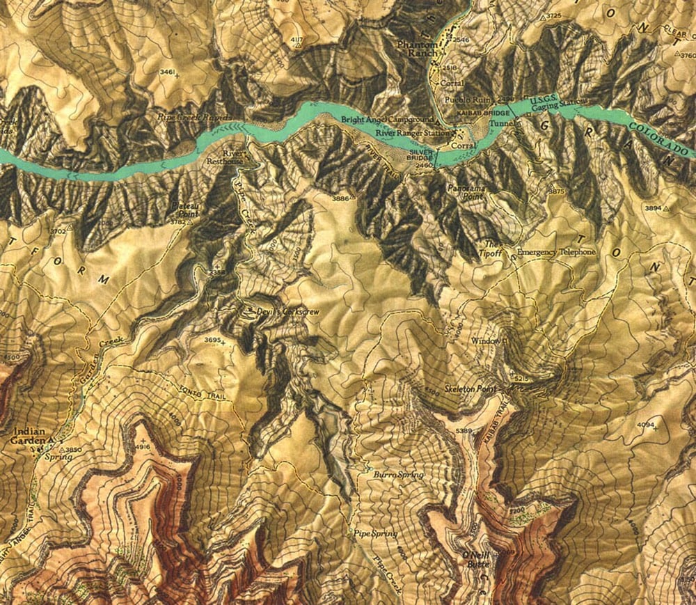
Here’s a closeup view of part of the map, which shows just how much detail is there:
Often Washburn was dropped off on top of a pinnacle or small butte along with surveying equipment, such as a state-of-the-art laser range-finder device still under development, on loan from the company that made it. Using a built-in telescope, Washburn would aim the helium-neon laser at a reflecting prism positioned on another point miles away. The laser beam would be reflected back to the range finder, which measured how long the beam’s round-trip took and translated that into distances that were accurate to within 6/100 of an inch per mile. Washburn used a 40-pound surveying instrument called a theodolite to measure the angles between each of the control points, providing him with the relative position and height of each set of points.
After a few weeks in the canyon, Washburn was convinced of the potential for “a map of really superlative beauty as well as topographic quality.” Knowing exactly where to find the expertise, and the funds, needed to realize that potential, he asked the National Geographic Society to join the project.
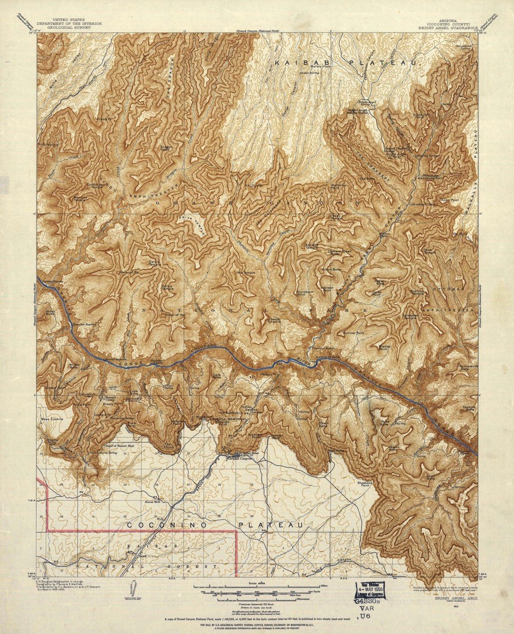
The surveying took years and then came the data analysis & production phases…it took over 1000 hours just to paint the relief shading onto the map. If you want to compare Washburn’s map to earlier efforts, check out this post at Codex 99. This 1903 USGS map was the best map into the 1960s:
Even in the age of crisp satellite views in Google Maps, The Heart of the Grand Canyon is a beautiful and useful map. You can purchase a copy of the 1978 map (and a refreshed 1999 version) from the National Geographic store.
Socials & More