Explore an Incredibly Detailed Topographical Map of the Moon
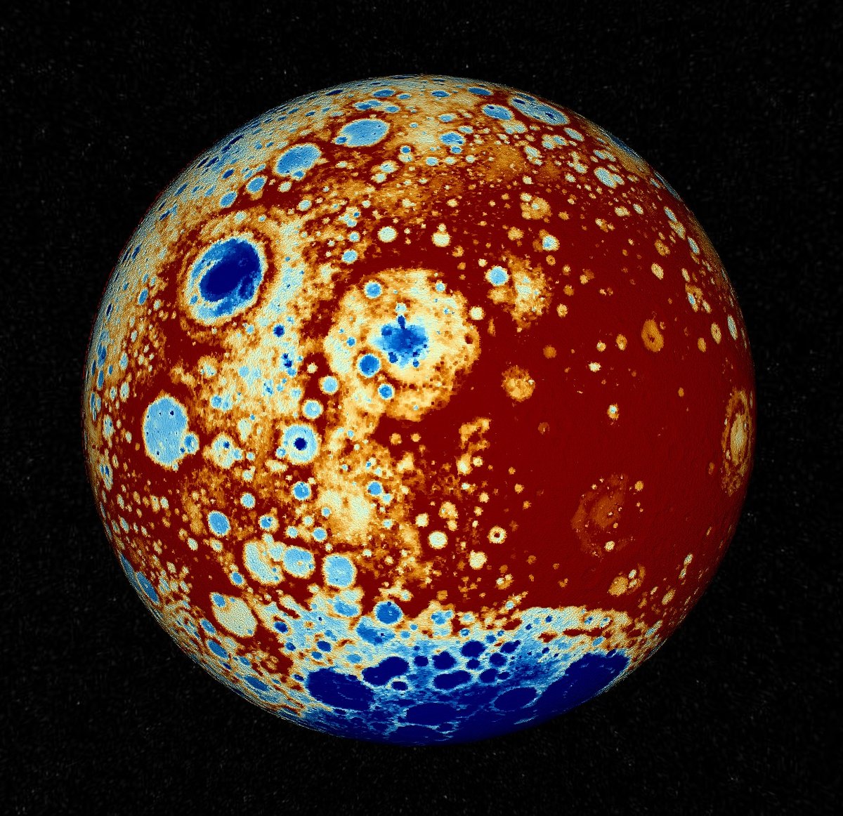
Moon Lidar is a visualization of the data collected by NASA’s Lunar Orbiter Laser Altimeter (LOLA) mission. According to this factsheet, the visualization includes nearly six billion measurements.
LOLA data was captured by a polar orbiting laser altimeter. Think of it like the range finder you would use to measure how far away the hole is from your current position at a golf course, except you press the button six billion times, save the position from where you are measuring, save every distance measurement on a hard drive, and then phone that data back to earth.
Comments 2
The LOLA is actually mounted on LROC, a more-or-less permanent satellite orbiting the Moon. There is a page with a ton of great LROC images that includes some descriptions of each. Check out the boulder right in the middle of Tycho!
@kottke You will love https://quickmap.lroc.asu.edu/ and https://mars.quickmap.io. There are others for Mercury and Venus.
If you feel like this comment goes against the grain of the community guidelines or is otherwise inappropriate, please let me know and I will take a look at it.
This thread is closed for new comments & replies. Thanks to everyone for participating!