Map of Pangaea with Modern-Day Borders
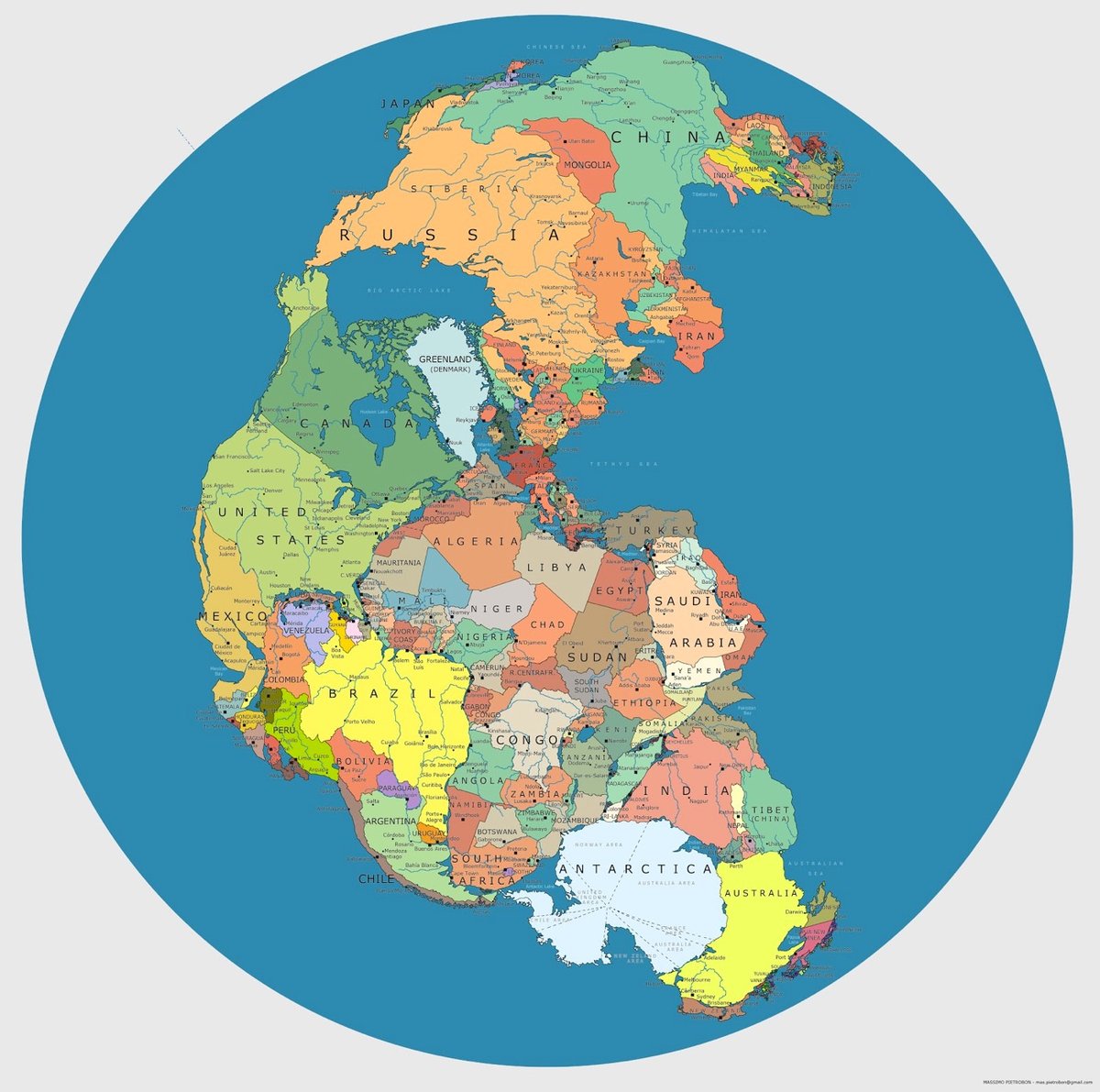
Pangaea is a supercontinent that formed on Earth about 335 million years ago and began to break up about 175 million years ago, eventually forming the familiar continents of today. Massimo Pietrobon made a map that shows where our modern country borders would appear on Pangaea. Check out the full-size version here.
See also Locate Modern Addresses on Earth 240 Million Years Ago. (via @owacle)
Socials & More