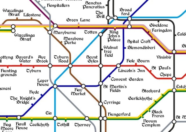
Ye Olde Medieval Tube Map

Londonist created a map of the London Underground with station names contemporary to medieval London.
The medieval period spans something like 1,000 years, covering the centuries from the Roman withdrawal around 400 AD to the rise of the Tudors in the late 15th century. Place names, of course, changed greatly over this time and those on the map were not necessarily all in use at the same time. Where applicable, we’ve favoured spellings used in the Domesday survey of 1086. Elsewhere, we’ve taken the earliest recorded version of a place name.


Stay Connected