Visualizing the History of Pandemics
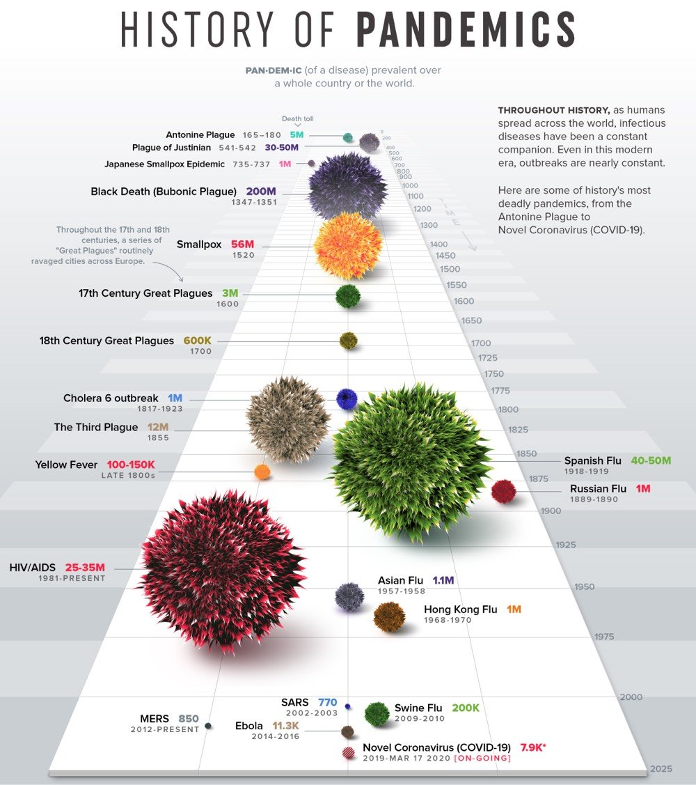
From Nicholas LePan, Visualizing the History of Pandemics.
The practice of quarantine began during the 14th century, in an effort to protect coastal cities from plague epidemics. Cautious port authorities required ships arriving in Venice from infected ports to sit at anchor for 40 days before landing — the origin of the word quarantine from the Italian “quaranta giorni”, or 40 days.
One of the first instances of relying on geography and statistical analysis was in mid-19th century London, during a cholera outbreak. In 1854, Dr. John Snow came to the conclusion that cholera was spreading via tainted water and decided to display neighborhood mortality data directly on a map. This method revealed a cluster of cases around a specific pump from which people were drawing their water from.
While the interactions created through trade and urban life play a pivotal role, it is also the virulent nature of particular diseases that indicate the trajectory of a pandemic.
One of my big takeaways from the Tracking Infectiousness section of the piece is: holy shit, look at how contagious measles is! An R0 of 16! (The common flu is about 1.5 and ebola is 2.0.) And people want to keep their children from getting vaccinated for this?!
Socials & More