The United States of Voronoi
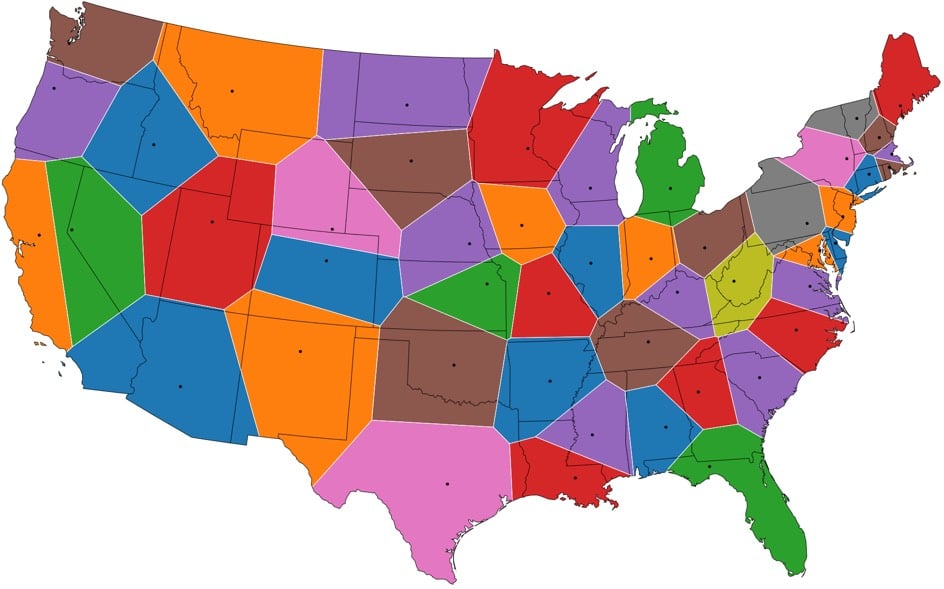
From Jason Davies, this is a US map where the state borders have been redrawn so that all points closest to a state capital than to any other form a state a la Voronoi diagrams. See also Voronoi maps of world airports and world capitals.
It’s interesting that many of the states’ new shapes are similar to their current ones, suggesting that the placement of the capitals relative to borders was somewhat naturally Voronoi-esque, like how people naturally space themselves in elevators or parks.
Socials & More