Meander Maps for Imaginary Rivers
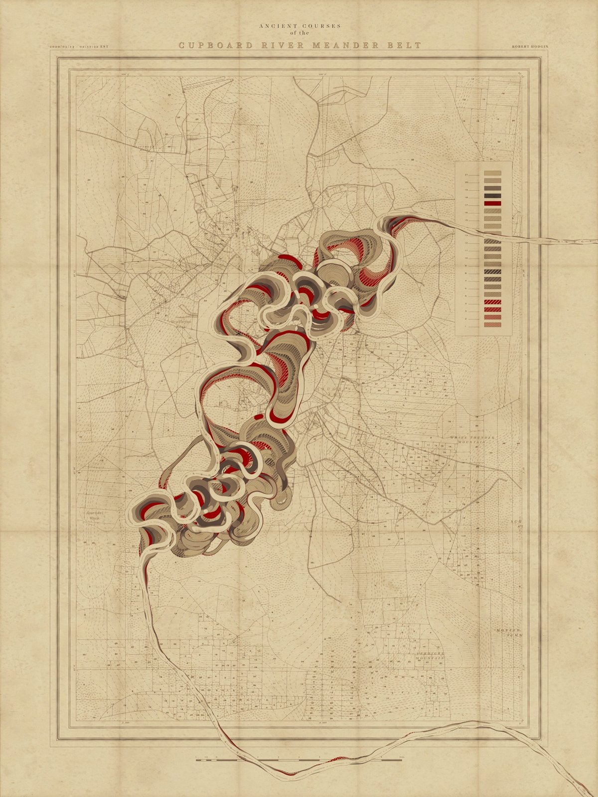
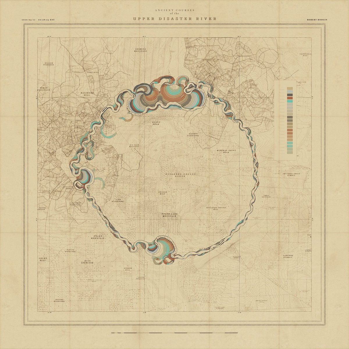
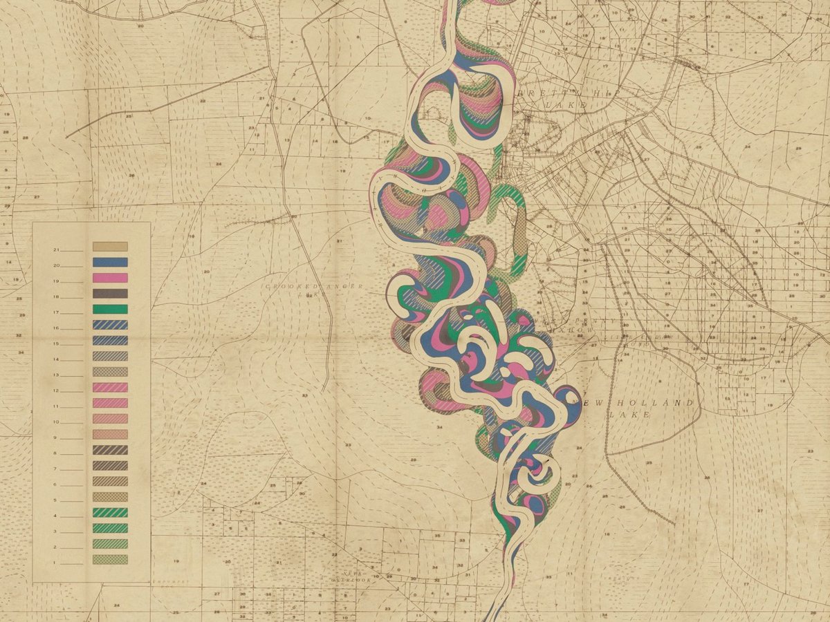
I have written previously about cartographer Harold Fisk’s wonderful meander maps of the Mississippi River produced for the Army Corps of Engineers. Borrowing the aesthetic of these maps, interactive artist & engineer Robert Hodgin wrote some software called Meander to generate meander maps for fictional rivers.
From an input curve, the terrain, land plots, side roads, highways, marsh land and mountain peaks are generated and prominent features are named. The map is then weathered and rendered in the style of old US Army Corp of Engineers maps from the 1930s and 40s.
You can check some of the generated maps out on Twitter or on Instagram, including some prototypes and animations (this one is my favorite). Hodgin has promised a full write-up of the project; I’ll link to it when he publishes it.
Coincidentally, while I was writing this post I got an email from a reader about an audiovisual installation called Meandering River that displayed “real-time visuals generated by an algorithm and music composed by an A.I.”
Synchronicity!
Update: Hodgin wrote about the Meander project on his website and included several more gorgeous examples of his output.
Socials & More