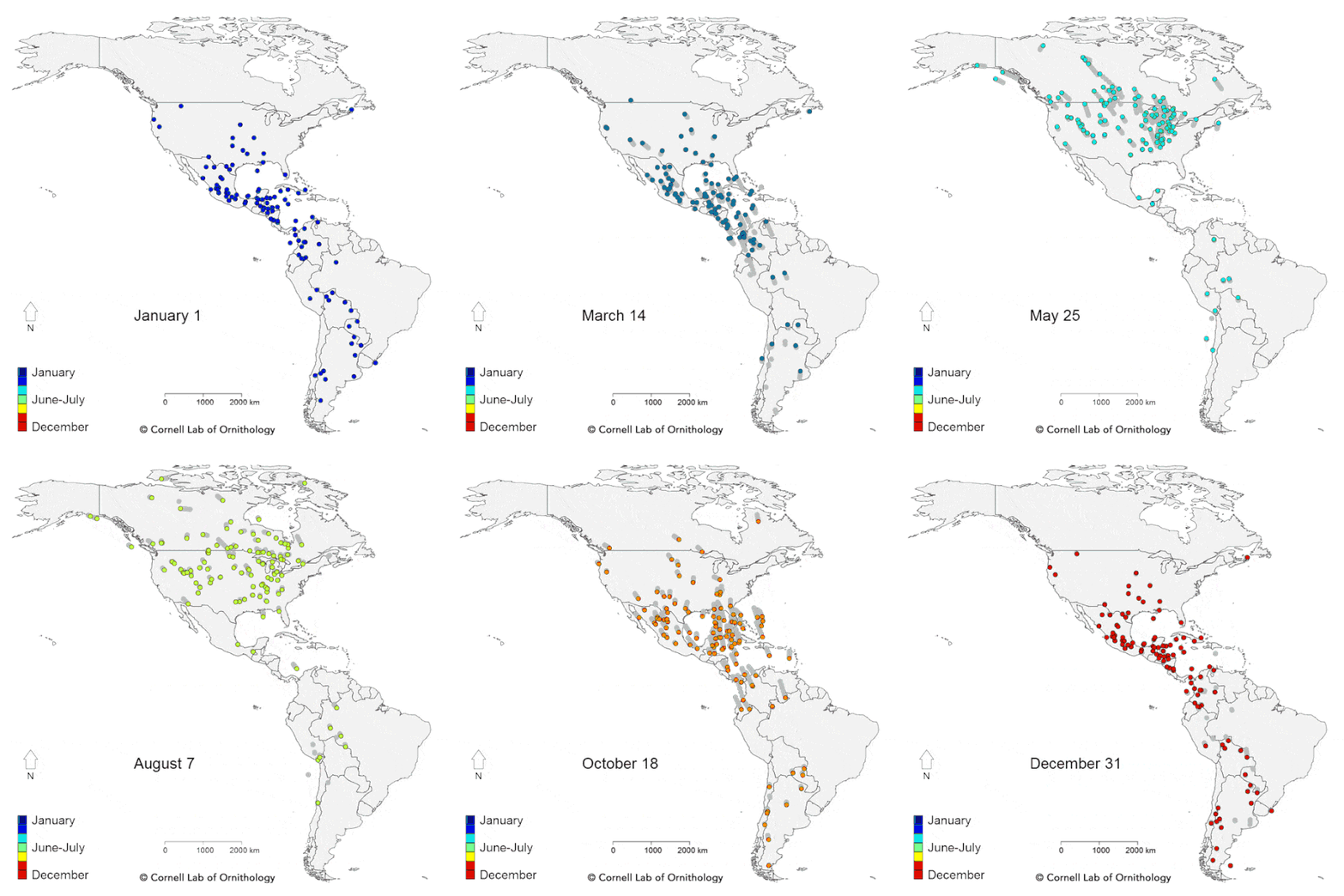
Migration map of American birds

From the Cornell Lab of Ornithology, an animated map of the yearly migratory patterns of 118 bird species in the Western Hemisphere.
La Sorte says a key finding of the study is that bird species that head out over the Atlantic Ocean during fall migration to spend winter in the Caribbean and South America follow a clockwise loop and take a path farther inland on their return journey in the spring. Species that follow this broad pattern include Bobolinks, Yellow and Black-billed cuckoos, Connecticut and Cape May warblers, Bicknell’s Thrush, and shorebirds, such as the American Golden Plover.
“These looped pathways help the birds take advantage of conditions in the atmosphere,” explains La Sorte. “Weaker headwinds and a push from the northeast trade winds as they move farther south make the fall journey a bit easier. The birds take this shorter, more direct route despite the dangers of flying over open-ocean.”
The map was created with data from eBird, a database of crowdsourced bird sightings. They also created a follow-up map which labels each of the species. Look at how far Baird’s Sandpiper (#5) flies…all the way from central Argentina to Northern Canada and back. (thx, kevin)


Stay Connected