The Atlas of Design

The North American Cartographic Information Society has published the third volume of The Atlas of Design, a book consisting of “beautiful and inspiring maps from around the world”.
National Geographic took a look at some of the maps included in the book.
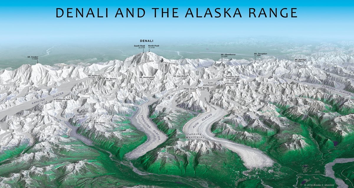
The striking panorama above of Denali and the Alaska Range was created by draping satellite imagery over a three-dimensional model of the terrain. Brooke Marston, a cartographer at the U.S. State Department’s Bureau of Intelligence and Research, was inspired by the Austrian artist Heinrich Berann, who is famed for his beautiful panoramas of mountain ranges.
While Berann took some artistic license with the precise location and positioning of mountains in his panoramas, Marston’s map is true to the geography. The oblique, bird’s-eye view emphasizes the sheer size of the mountains while maintaining a closeness with the viewer. “Good oblique mapping can transport the viewer straight into the landscape,” Elmer says. “This map makes me feel lost among the jagged, cold, majestic mountains just looking at it.”


Stay Connected