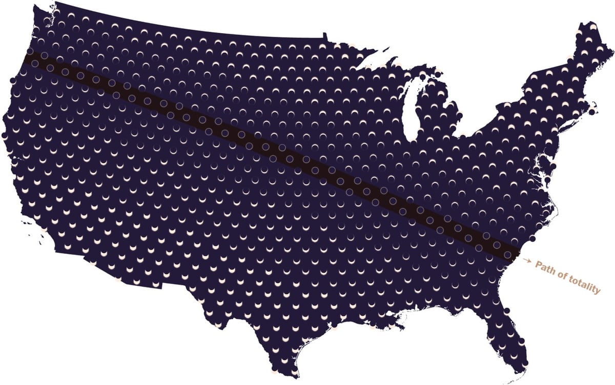
The Washington Post has a cool series of maps related to the total solar eclipse happening in August. The one above is a one-shot view of what the Sun will look like across the US on August 21 and there are other maps with captions like “The last eclipse over these areas occurred before Columbus’s arrival in 1492” and “Total solar eclipse paths over the continental U.S. since 2000 B.C.”
In the last 100 years, some areas have been in the paths of multiple eclipses: New England, for example, saw four. (During its World Series dry spell from 1918 to 2004, the greater Boston area alone saw two.)
Others weren’t so lucky. Just 200 miles away in New York, construction on the Empire State Building had not started yet the last time the city saw a total solar eclipse (1925). San Diego had a population of less than 100,000 the last time it was eclipsed (1923), and Chicago hasn’t seen a total eclipse at all in the last 100 years. An area near Tucson has the longest dry spell in the Lower 48: The last total solar eclipse it saw was in the year 797.
The U.S. mainland has averaged about seven total solar eclipses per century since 2000 B.C. Some areas have seen as many as 25 eclipses, while others, such as spots west of Minneapolis, have seen only four in the last four millennia.
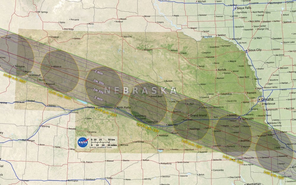
Using data about the Moon’s terrain from the Lunar Reconnaissance Orbiter as well as elevation data on Earth, NASA’s Ernie Wright created a very accurate map of where and when the August 2017 eclipse will occur in the United States.
Standing at the edge of the moon’s shadow, or umbra, the difference between seeing a total eclipse and a partial eclipse comes down to elevation — mountains and valleys both on Earth and on the moon — which affect where the shadow lands. In this visualization, data from NASA’s Lunar Reconnaissance Orbiter account for the moon’s terrain that creates a jagged edge on its shadow. This data is then combined with elevation data on Earth as well as information on the sun angle to create the most accurate map of the eclipse path to date.
You can download maps of your area from NASA’s official eclipse website…I will be studying the Nebraska map closely.
See also Eclipse Megamovie 2017, an eclipse simulator you can use to check what the eclipse will look like in the sky in your area, and what looks like an amazing eclipse watching festival put on by Atlas Obscura.
I do not officially have a bucket list1 but if I did have one, watching a total solar eclipse would be on it. Was just talking about it the other day in fact. Well. I am pretty damn excited for the Great American Eclipse of 2017!
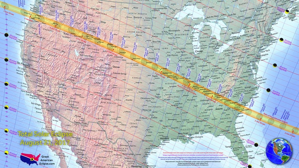
In August 21, 2017, millions of people across the United States will see nature’s most wondrous spectacle — a total eclipse of the Sun. It is a scene of unimaginable beauty; the Moon completely blocks the Sun, daytime becomes a deep twilight, and the Sun’s corona shimmers in the darkened sky. This is your guide to understand, prepare for, and view this rare celestial event.
It goes right through the middle of the country too…almost everyone in the lower 48 is within a day’s drive of seeing it. Cities in the path of the totality include Salem, OR, Jackson, WY, Lincoln, NE, St. Louis, MO (nearly), Nashville, TN, and Charleston, SC.
Weather will definitely play a factor in actually seeing the eclipse, so I will be keeping an eye on Eclipser (“Climatology and Maps for the Eclipse Chaser”) as the event draws near. Early analysis indicates Oregon as the best chance for clear skies. Matt, I am hereby laying claim to your guest room in three years time. So excited!!





Socials & More