Aerial Photo of Manhattan, Circa 1931
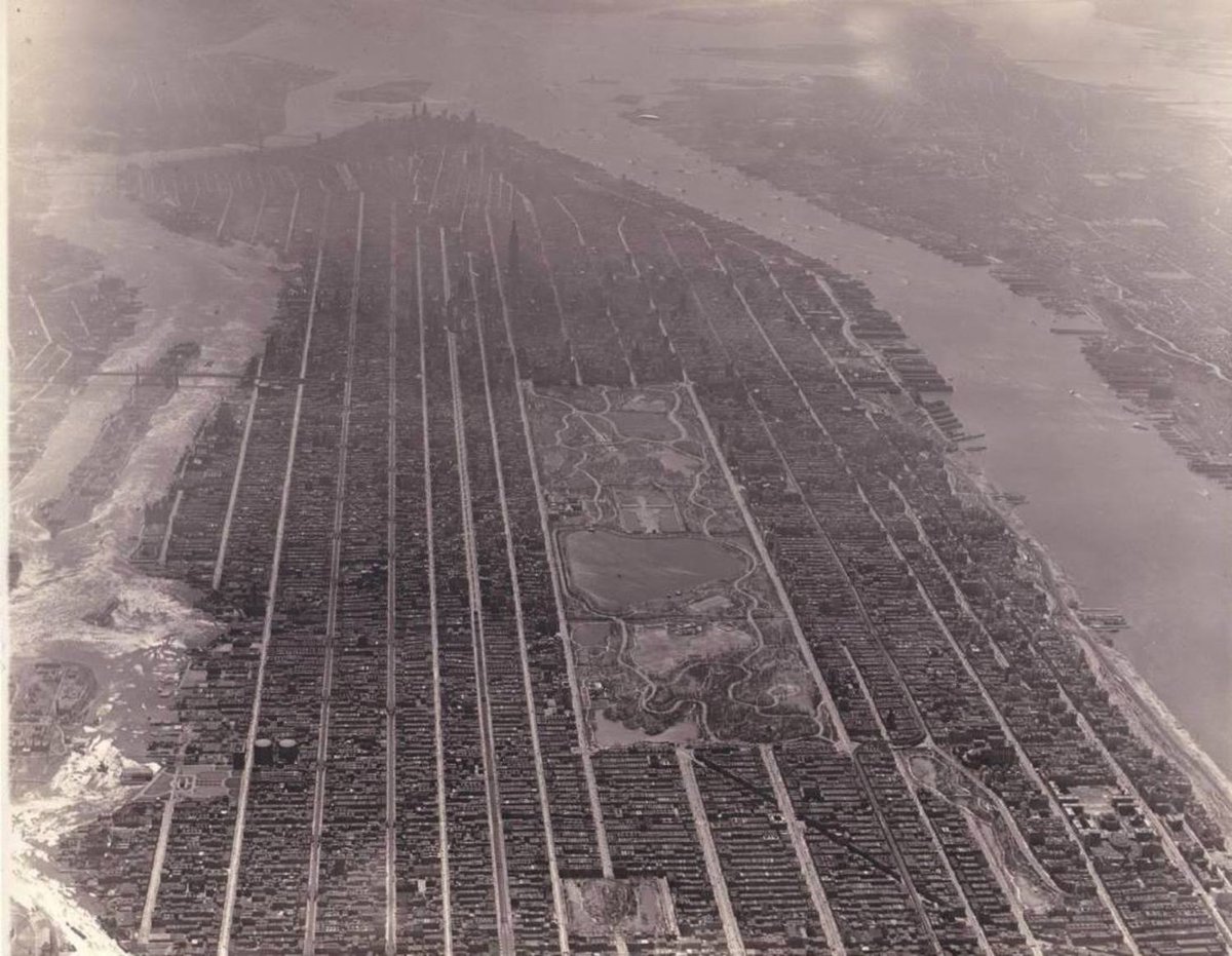
This is an aerial photo of Manhattan taken circa 1931. You can see all the way from 125th Street in Harlem down to the tip of Manhattan and beyond. That tall spike 25 blocks south of Central Park is the Empire State Building, which was completed in 1931. Also visible in the photo to varying degrees: Central Park’s Hooverville, the Statue of Liberty, several of the East River’s bridges, the Metropolitan Museum of Art, Governors Island, and the much more uneven shorelines on both the Hudson and East River sides of the city. See also this aerial map of NYC from 1924, which is also available at NYCityMap (click on “Map Type” in the upper right) and a 1931 aerial photo of lower Manhattan.
Note: I tried and failed to track down the source and exact date of this photo. The earliest instances I could find were uncredited posts on Reddit and Facebook from a couple of years ago. Any idea where this came from? Would love to properly credit the source and nail down the year. (via @marinamaral2)
Socials & More