Homemade Maps of People’s Limited Surroundings During the Pandemic
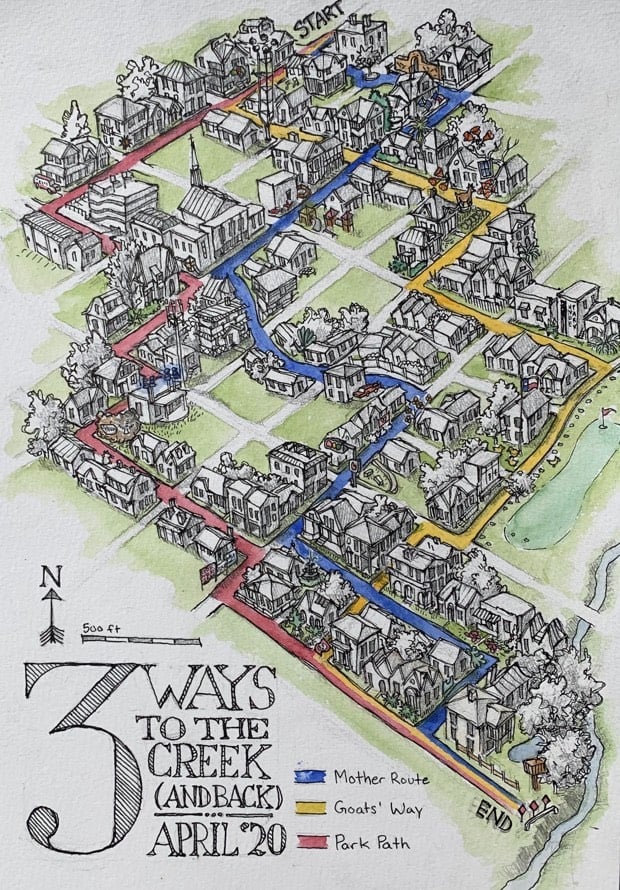
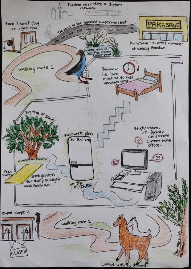
CityLab asked its readers to “draw maps of their worlds in the time of coronavirus”. They drew floor plans, neighborhood walking diagrams, and more abstract representations of their surroundings.
You charted how your homes, neighborhoods, cities and countries have transformed under social distancing and stay-at-home orders around the planet, from daily work routines and the routes of your “sanity walks,” to the people you miss and the places you fled.
While most used markers, pens, and computer-based drawing tools to sketch maps by hand, some used watercolors, clay, and photography. Some were humorous, others heart-wrenching - between them all, a full spectrum of quarantine-era emotion emerged.
(via @ctsinclair)
Socials & More