The Drawings Secretly Inserted into Official Swiss Topographical Maps
For decades, mapmakers working for the Swiss Federal Office of Topography have defied their mandates to create the most accurate maps possible by covertly inserting drawings in official maps.
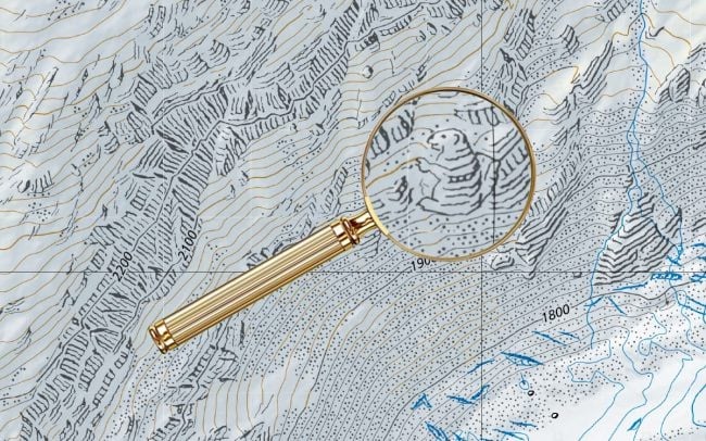
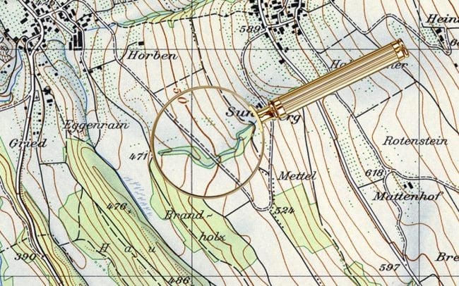
But on certain maps, in Switzerland’s more remote regions, there is also, curiously, a spider, a man’s face, a naked woman, a hiker, a fish, and a marmot. These barely-perceptible apparitions aren’t mistakes, but rather illustrations hidden by the official cartographers at Swisstopo in defiance of their mandate “to reconstitute reality.” Maps published by Swisstopo undergo a rigorous proofreading process, so to find an illicit drawing means that the cartographer has outsmarted his colleagues.
It also implies that the mapmaker has openly violated his commitment to accuracy, risking professional repercussions on account of an alpine rodent. No cartographer has been fired over these drawings, but then again, most were only discovered once their author had already left. (Many mapmakers timed the publication of their drawing to coincide with their retirement.)
Some of these blend remarkably well within the usual details of the maps — I never would have noticed the reclining nude in the second image above if it weren’t highlighted.
See also trap streets, errors deliberately introduced by mapmakers to catch others copying their work. (via @jschulenklopper)
Socials & More