A Map of Mormon Geological Theology
Boston Rare Maps recently sold a nine-foot-high cloth map from 1899 that shows a geographic interpretation of the Book of Mormon.
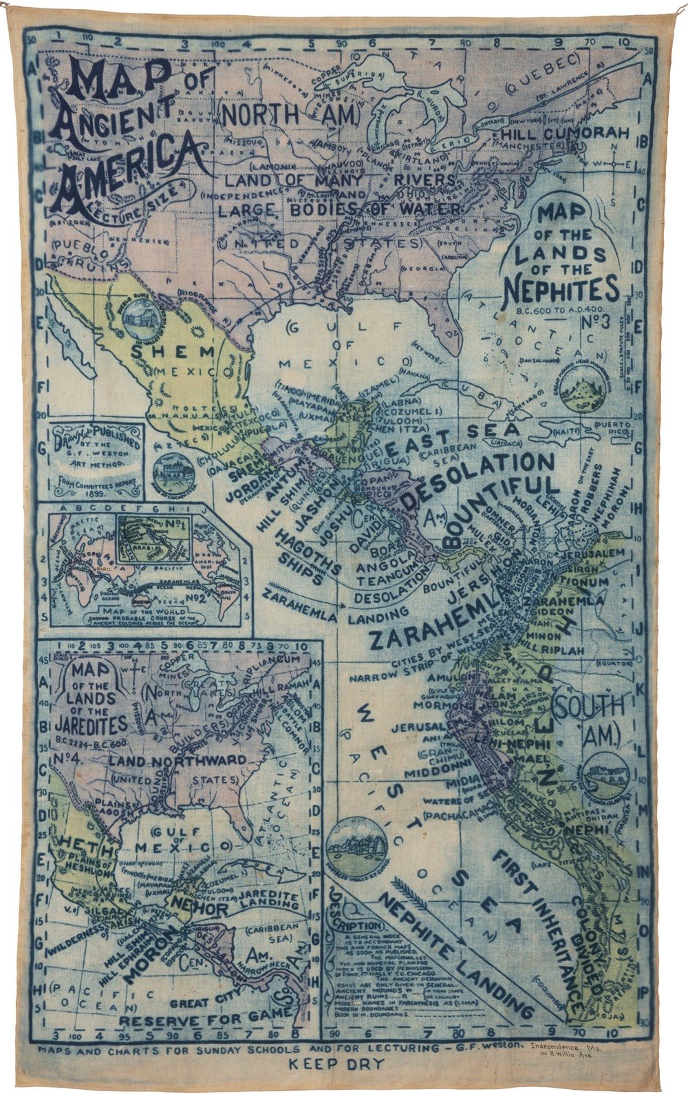
The map was an official production of the Reorganized Church of Jesus Christ of Latter Day Saints (RLDS) in Independence, Missouri. The RLDS (known since 2001 as the Community of Christ), is a reformist branch of the Church of Latter Day Saints, established in 1860.
You can read more about the proposed setting of the Book of Mormon on Wikipedia and its adherents’ belief that the indigenous peoples of the Americas are descended from Israelites.
The Book of Mormon is based on the premise that two families of Israelites escaped from Israel shortly before the sacking of Jerusalem by Nebuchadnezzar and that they constructed a ship, sailed across the ocean, and arrived in the New World as founders of Native American tribes and eventually the Polynesians. Adherents believe the two founding tribes were called Nephites and Lamanites, that the Nephites were white and practiced Christianity, and that the Lamanites were rebellious and received dark skin from God as a mark to separate the two tribes. Eventually the Lamanites wiped out the Nephites around 400 AD, leaving only dark skinned Native Americans. The descent of Native Americans from Israel is a key part of The Church of Jesus Christ of Latter-day Saints’s foundational beliefs.
(via @john_overholt)
Socials & More