19th Century Chart of Cities’ Distances from Washington DC
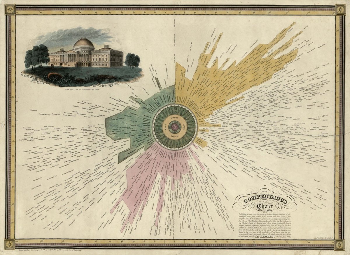
As you should know by now, I am a sucker for 19th century infographics. This “compendious chart” from the Library of Congress shows the distances and compass directions of about 1300 cities from the central point of Washington DC. You can zoom in on the chart to check out the detail:
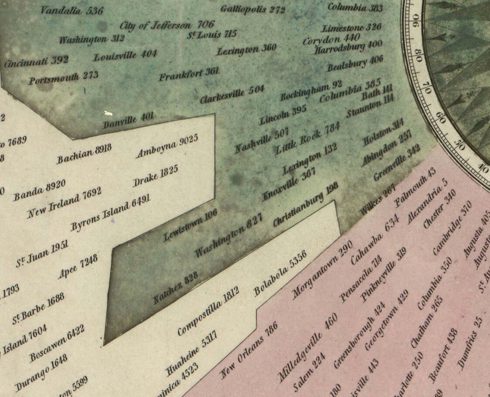
The map doesn’t say what the colors signify — there’s also a black & white version — but it was created in 1827 so perhaps they denote the three parts of the country at the time: yellow is the North, pink is the South, and green is the West.
Socials & More