An Ultra-High Resolution Map of Antarctica
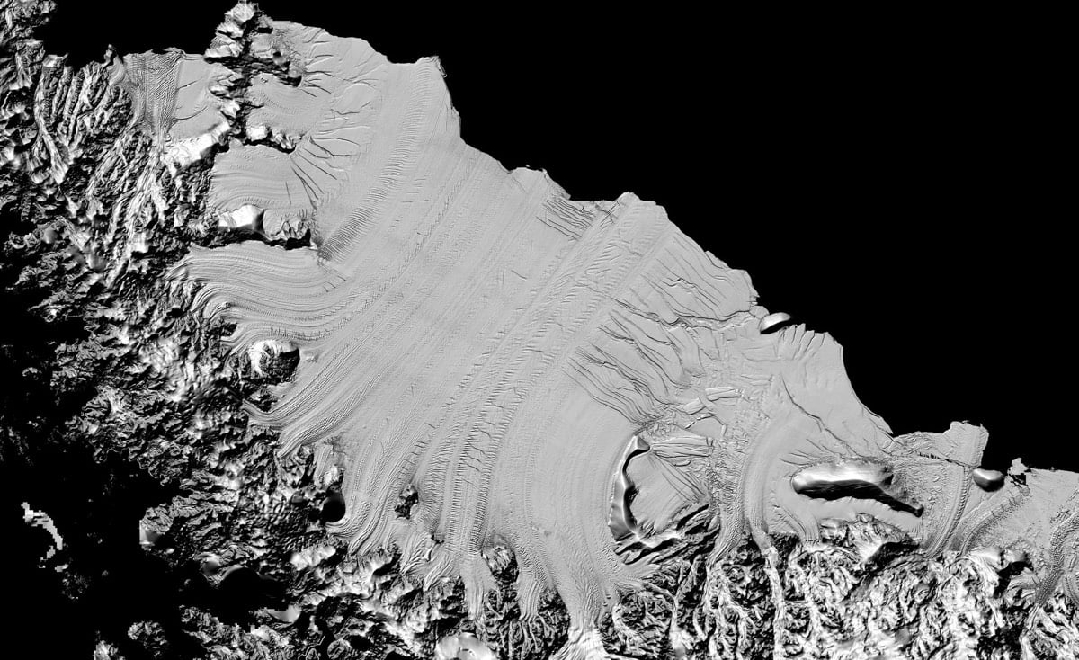
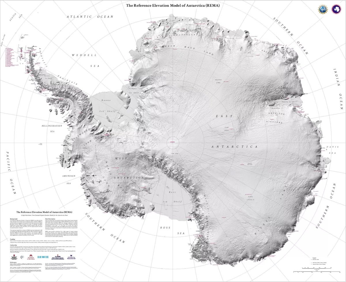
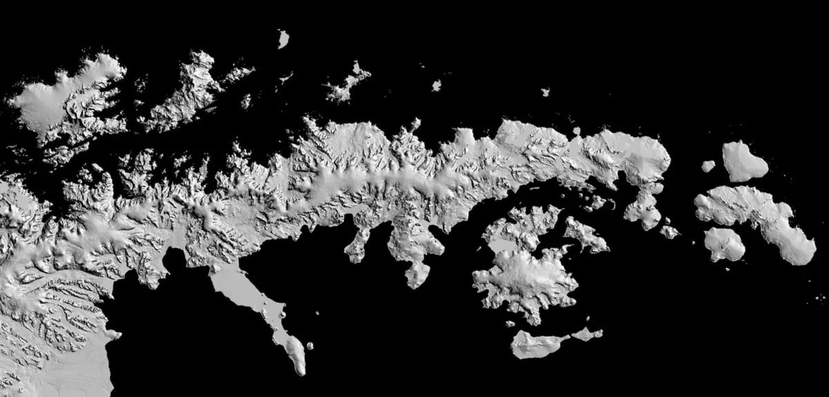
Using years of satellite data and photography, researchers have constructed an extremely detailed terrain map called the Reference Elevation Model of Antarctica that maps 98% of the continent down to a resolution of 8 meters. That makes it the most detailed terrain map of any continent. The NY Times has the skinny on the new map.
Previous maps of the continent had a resolution similar to seeing the whole of Central Park from a satellite. With this new data, it is now possible to see down to the size of a car, and even smaller in some areas. The data is so complete that scientists now know the height of every feature on the continent down to a few feet.
“If you’re someone that needs glasses to see, it’s a bit like being almost blind and putting on glasses for the first time and seeing 20/20,” said Dr. Howat.
The team used 187,585 images collected over six years to create the map.
“Until now, we’ve had a better map of Mars than we’ve had of Antarctica,” said Dr. Howat.
Socials & More