Population estimates for user-drawn shapes on a map
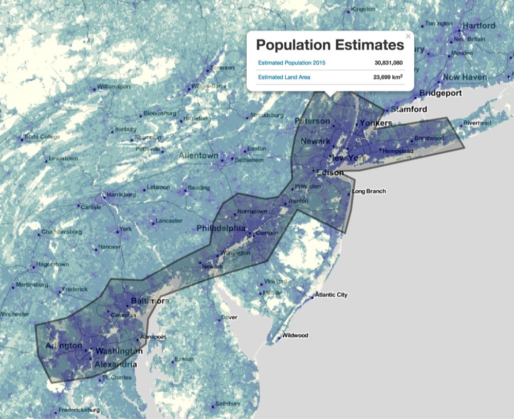
NASA has built a service for estimating populations, part of which is a map hosted by Columbia on which you can draw a circle or a shape and the map will give you an estimate of the population contained by the shape. You can also access the service via an API…just send it polygonal coordinates and it returns population data.
Just for fun, I drew a small circle with an area of ~7000 sq. km and dragged it around to different spots on the globe:
NYC: 15,251,980
Rural Wyoming: 31
London: 12,972,590
Lagos, Nigeria: 14,106,980
Mumbai: 24,513,630
Tibet: 2,226
Seoul: 23,439,930
Tokyo: 32,572,740
Mexico City: 21,319,990
Socials & More