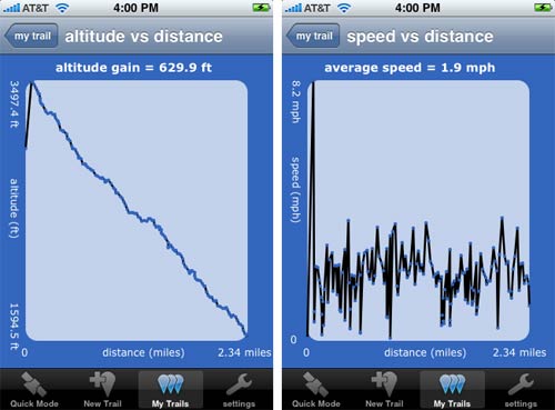
iTrail
When we were up in Vermont earlier this month, we rode the single chair to the top of the mountain at Mad River Glen and then hiked down. Before we left, we installed iTrail on Meg’s phone. iTrail uses the iPhone’s GPS capability to track your progress along a trail, jogging path, etc. The reviews at the iTunes Store aren’t glowing but we found that it worked pretty well for us. Here are a couple of graphs generated by iTrail of our hike:
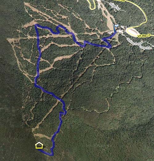
iTrail also allows data export to a Google Docs speadsheet. From there, you can import that data into Google Maps, like so:
It’s not perfect (we weren’t doing 8.2 mph at the beginning of the hike) and GPS mapping apps are hardly new, but I’ve never done this before and it feels like living in the future.
Socials & More