The Marvelous Mississippi River Meander Maps
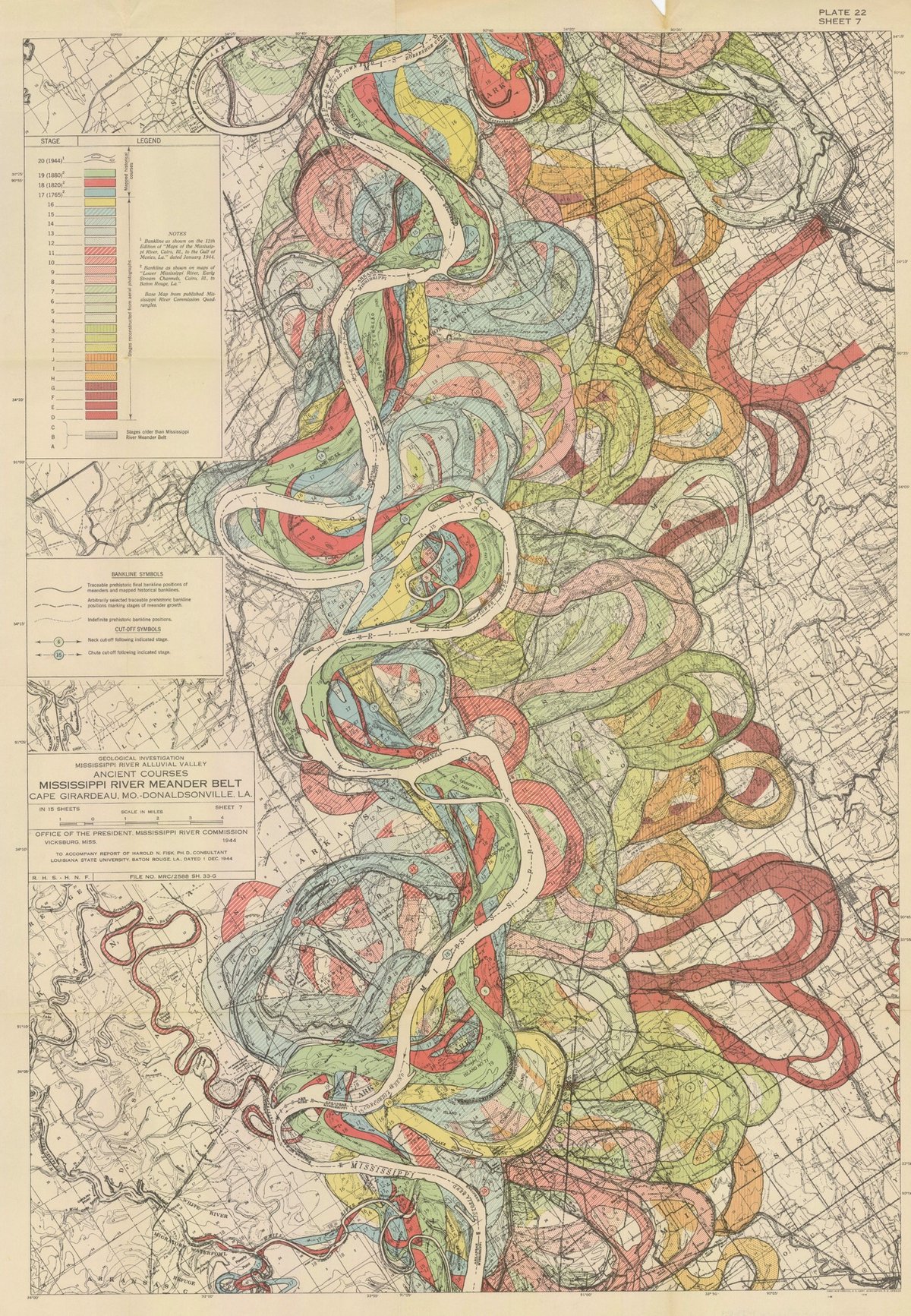
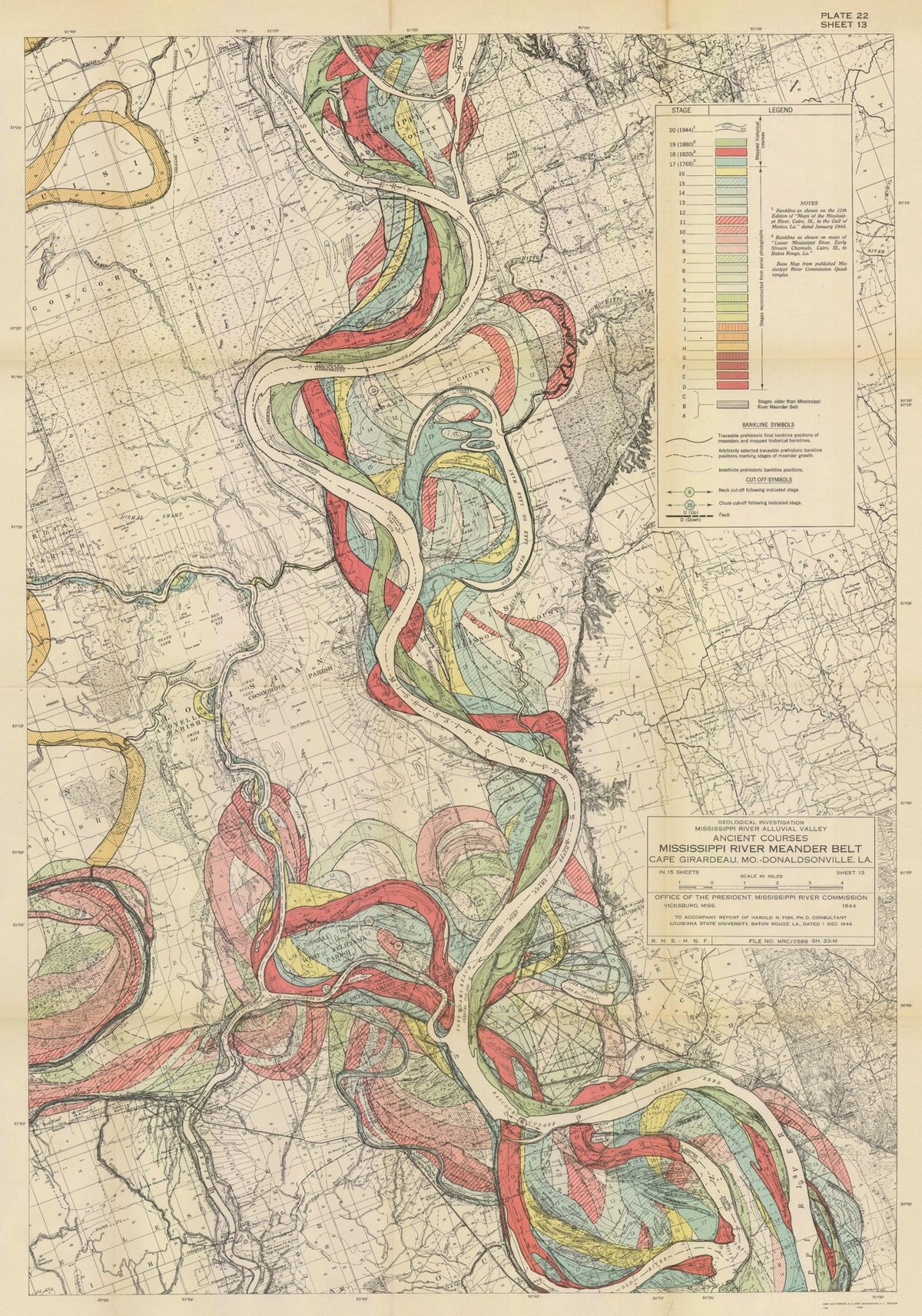
I have long admired the Mississippi River meander maps designed by Army Corps of Engineers cartographer Harold Fisk but have somehow never written a whole post about them. So when my pals at 20x200 reached out wanting me to write a blog post for them about their Fisk prints, I jumped at the chance. It gave me an excuse to write about art as time travel and, in particular, how Fisk’s clever map compresses thousands of years of a river’s activity into a single image.
It takes some imagination, but standing before a painting by Hilma af Klint, a sculpture by Bernini, or a cave painting in Chauvet, France draws you back in time in a powerful way: you know you’re standing precisely where those artists stood hundreds or even thousands of years ago, laying paint to surface or chisel to stone. Even experiencing art through prints or photographs leads the mind to consider all the cultural, political, technological, and economic things that were happening when the work was produced. Art is a doorway to past worlds.
Fisk’s maps represent the memory of a mighty river, with thousands of years of course changes compressed into a single image by a clever mapmaker with an artistic eye. Looking at them, you’re invited to imagine the Mississippi as it was during the European exploration of the Americas in the 1500s, during the Cahokia civilization in the 1200s (when this city’s population matched London’s), when the first humans came upon the river more than 12,000 years ago, and even back to before humans, when mammoths, camels, dire wolves, and giant beavers roamed the land and gazed upon the river.
You can buy prints of Fisk’s maps at 20x200…they have several available at all kinds of different sizes, framed and unframed.
Update: With LIDAR, the past meanderings of rivers can be seen more clearly (and no less artistically) than in Fisk’s maps. Here’s a LIDAR image of the Mississippi River along the border of Arkansas and Mississippi:
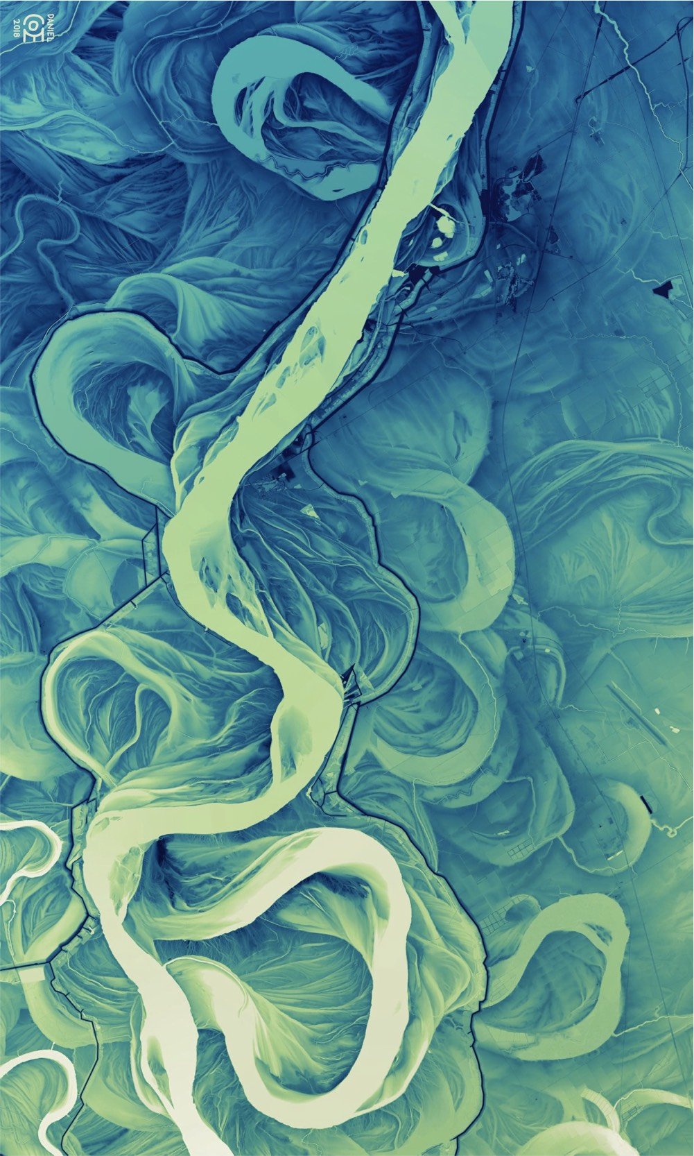
And don’t miss Daniel Coe’s morphing GIF of Fisk’s map to the LIDAR image. (via @macgbrown)
Update: Ahhh, look at this meander quilt from Timna Tarr:
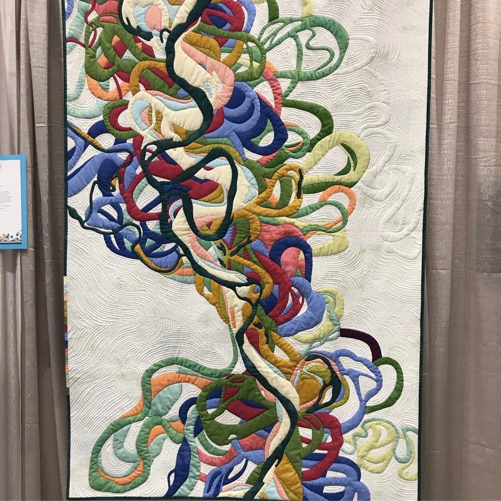
And check out some of the other quilts in her gallery…very cool. (thx, rachel)
Update: Cathy Fussell has also created quilts based on Fisk’s maps.
I don’t know if this needs a disclaimer or not, but 20x200 paid me a modest amount to write this blog post for their site but not the post you’re reading now. 20x200 didn’t pay me to write this here post; they didn’t even ask me if I would link to their post from my site. I once wrote a slightly longer (and progressively unhinged) disclaimer for a previous post about 20x200.
Stay Connected