Advertise here with Carbon Ads

This site is made possible by member support. โค๏ธ

Big thanks to Arcustech for hosting the site and offering amazing tech support.

When you buy through links on kottke.org, I may earn an affiliate commission. Thanks for supporting the site!

kottke.org. home of fine hypertext products since 1998.

๐Ÿ”  ๐Ÿ’€  ๐Ÿ“ธ  ๐Ÿ˜ญ  ๐Ÿ•ณ๏ธ  ๐Ÿค   ๐ŸŽฌ  ๐Ÿฅ”

County-by-county voting maps for the past 112 years

The Blaze has a collection of county-by-county election maps for every US Presidential election since 1900.

1932 Election Map

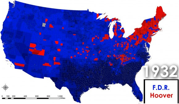
The video at the bottom is worth watching to witness the shift between a north/south divided country to a urban/rural divided country over the past 20 years.